Ladakh lies in northern India at the edge of the Himalaya, between the Karakoram and Zanskar ranges, where the Indus River traverses broad valleys at elevations of 3,000 to 5,000 metres. Annual precipitation in this region rarely exceeds 100 mm; winters are severe, summers brief, and intense solar radiation results in a landscape, no matter how stunning, defined by water scarcity. Farming and herding communities, connected through trading networks that extended across Central Asia, Tibet, and the Indo-Gangetic Plain, have long adapted to these conditions through various means of glacial meltwater management. Melted snow, carried by rivulets known as kangs-chhu (“ice water”), converges into streams (togpo) that feed a hierarchy of channels: the ma-yur (mother channel) cut along mountain slopes, from which smaller canals (yu-ra) distribute water to fields. At successive diversion points (yurgo and ska), flow is carefully regulated, before being guided across fields through fine channels (snang). These systems, sometimes reinforced with clay-lined embankments or even hollowed poplar trunks (va-to) to bridge difficult terrain, reflect a highly adapted hydraulic landscape attuned to scarcity and seasonal variability (Angchok et al. 2014; Nüsser and Baghel 2016).
Contemporary interventions extend this adaptive repertoire. Organisations such as Acres of Ice, working with communities in Ladakh, have developed artificial ice reservoirs and “ice stupas” that store surplus winter water and release it gradually during the spring growing season, thereby aligning water availability with agricultural demand. These systems combine local knowledge with sensor-based irrigation and engineering design to address what has been described as the region’s “water paradox”: abundance in winter, scarcity in spring (read about Acres of Ice here).
These innovations unfold within a context of increasing environmental instability. Recent climatological studies point to measurable shifts in Ladakh’s precipitation regime over the twentieth century. Analysis of long-term data (1901–2000) by Shafiq and colleagues, for instance, suggests a decline in summer precipitation alongside a statistically significant increase in winter precipitation, a trend with important implications for glacial mass balance and seasonal water availability in this high-altitude desert (Shafiq et al. 2016). If such studies establish broad climatic tendencies, the work of John Bray and his collaborators demonstrates how these trends are experienced episodically through extreme events. Widely regarded as a leading scholar of Ladakh, Bray has drawn on an unusually wide range of sources, combining geological evidence, instrumental records, and missionary and archival materials to reconstruct a detailed history of flooding in the region. His approach exemplifies the potential of historical climatology to extract fine-grained environmental data from dispersed and often fragmentary archives, identifying clusters of flood events and tracing shifts in precipitation intensity over time (Bray et al. 2024).
observation and exploration in nineteenth century Ladakh
From the early nineteenth century, colonial observers had already begun documenting these environmental conditions, recording local knowledge of weather alongside their own measurements. Emerging alongside British strategic interest in Ladakh’s passes and terrain, these efforts produced a body of observations that extends back to the 1820s. Among the earliest of these observers was William Moorcroft (1767–1825), a veterinary surgeon in the service of the East India Company, who reached Leh via the Indus in 1820 and remained there until 1822. His activities in Ladakh were shaped primarily by an interest in its role as a commercial hub within trans-Himalayan trade networks, particularly in relation to horses, pashmina wool, and other high-value commodities circulating between Central Asia, Tibet, and the Indian plains. His wide-ranging and voluminous writings are punctuated by careful observations of weather conditions, terrain, and patterns of resource use, offering an early empirical record of the region’s environment alongside its economic geography. Below is one of the earliest representations of Ladakh: a manuscript map produced by Moorcroft during his travels in the region in the early 1820s.
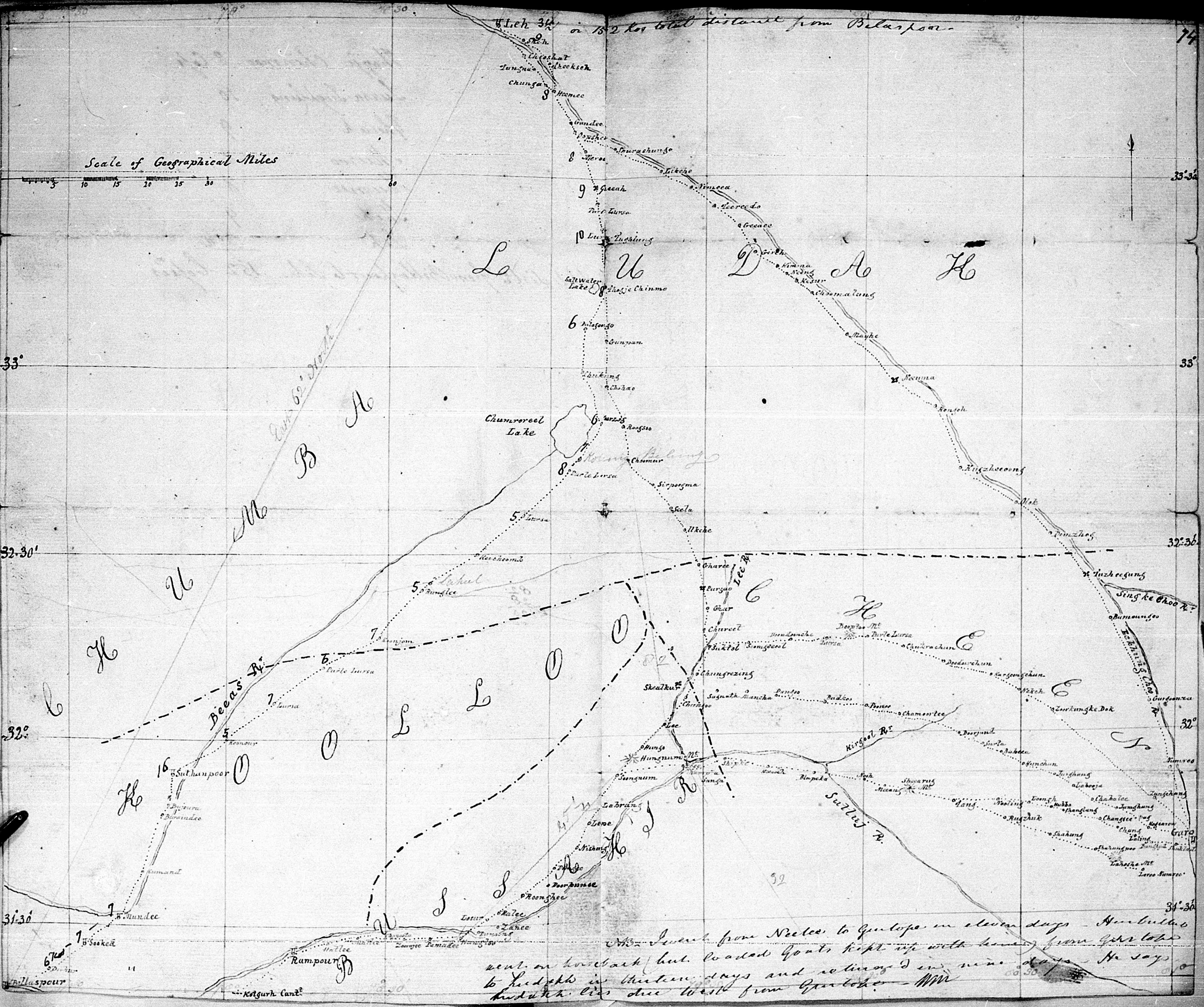
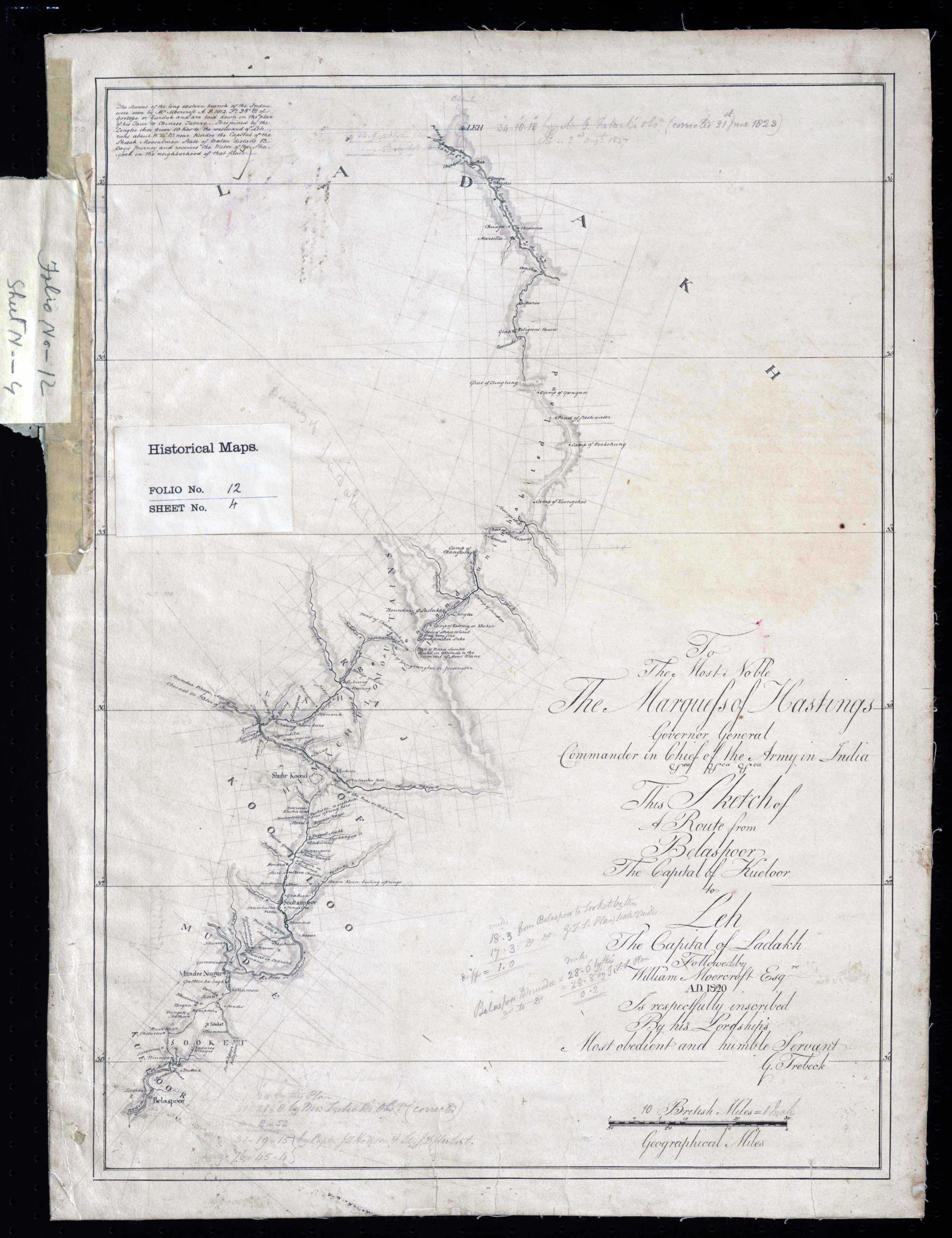
Moorcroft was, more broadly, a remarkably compelling and peripatetic figure, whose journeys across the Himalaya and Central Asia unfolded under often uncertain and precarious conditions. For those interested in exploring his life and travels in greater depth, a useful point of entry remains Travels in the Himalayan Provinces of Hindustan and the Punjab (Moorcroft et al. 1841). But Moorcroft’s journeys were only one instance within a wider stream of nineteenth-century travellers moving through Ladakh. The nineteenth century saw a succession of travellers, officials, and scholars pass through the region, many of them equally compelling in their own right, and each leaving behind accounts that reward closer attention. It would be impossible to do justice to all of them here; what follows therefore offers only a brief sweep of some of the more prominent figures, before turning to those whose work most directly shaped the climatological record.
In the decades after Moorcroft, the character of observation began to shift. Godfrey Vigne (1801–1863), travelling through Ladakh in the 1830s, still wrote in the idiom of the cultivated observer, recording weather, altitude, and seasonal change alongside political and social detail (Vigne 1842). By the 1840s and 1850s, however, figures such as Henry Strachey (1816–1912) and Thomas Thomson (1817–1878) approached the region differently. Strachey’s Physical Geography of Western Tibet (Strachey 1854) and its accompanying map—reproduced below and notably more refined than earlier representations—together with Thomson’s Western Himalaya and Tibet (Thomson 1852), register a growing concern with measurement: elevation, drainage, and regional structure were no longer incidental observations but objects of sustained inquiry. This shift is also visible in the visual materials that accompany these texts: the engraved view of iskardo (skardu, in present-day gilgit-baltistan, northwest of ladakh) that opens thomson’s volume (also reproduced below) renders the landscape with a degree of topographical attention that mirrors the increasing precision of mid-century observation.
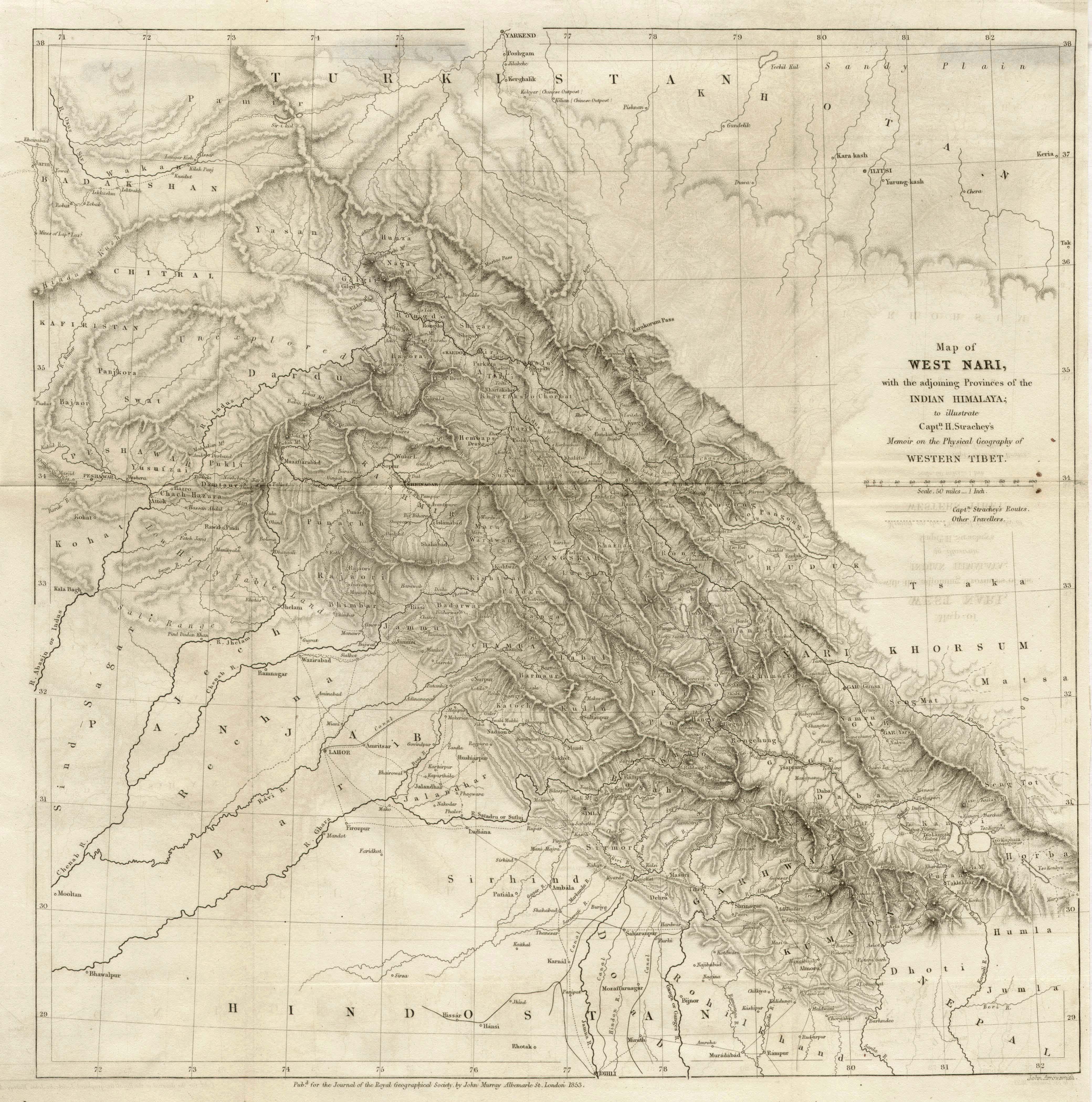 click to expand
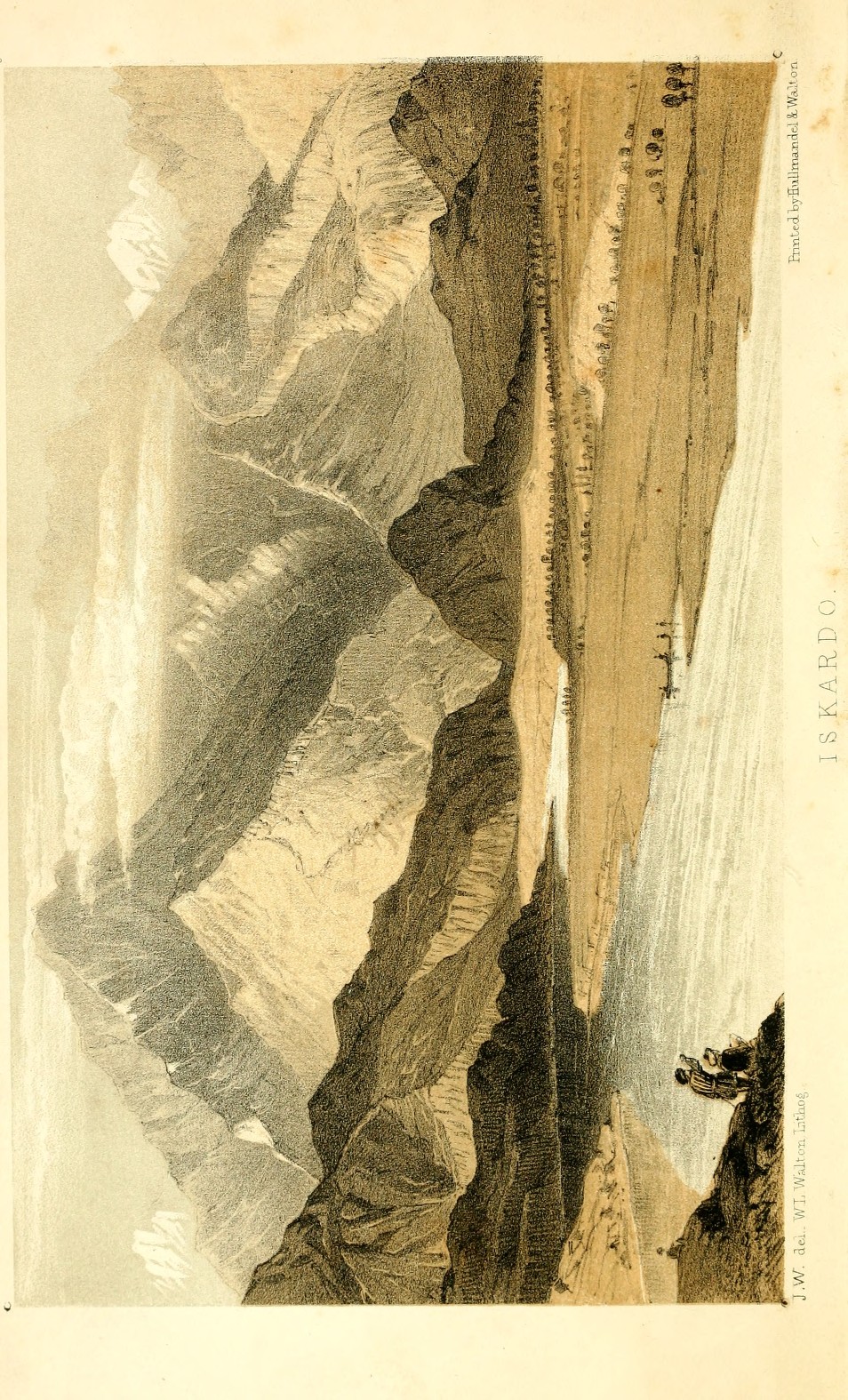 click to expand
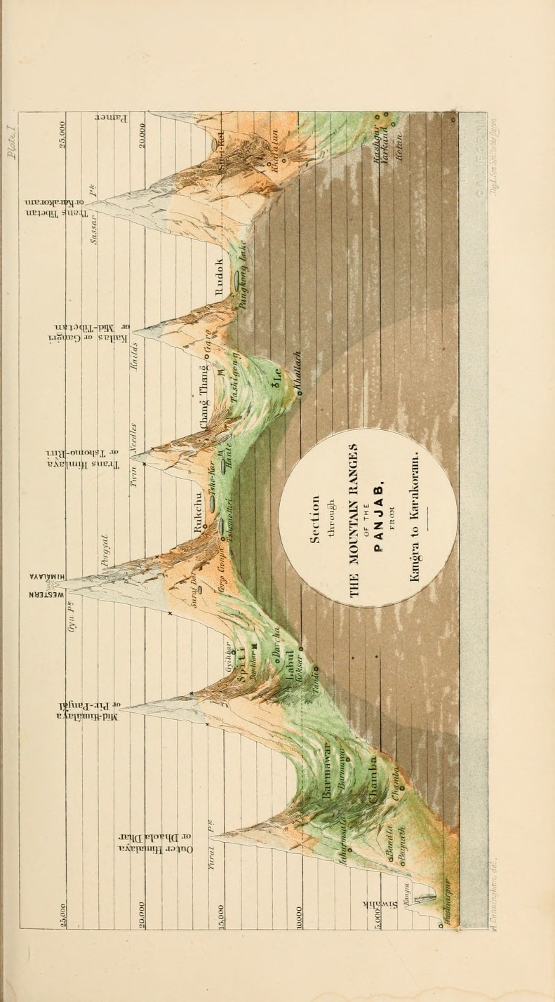
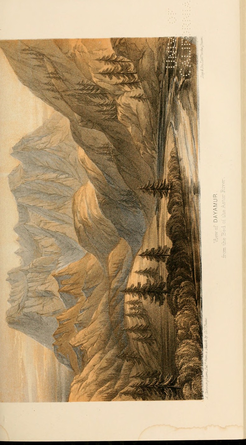
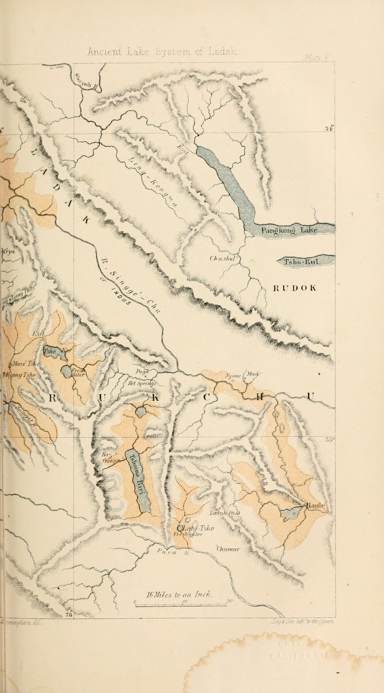
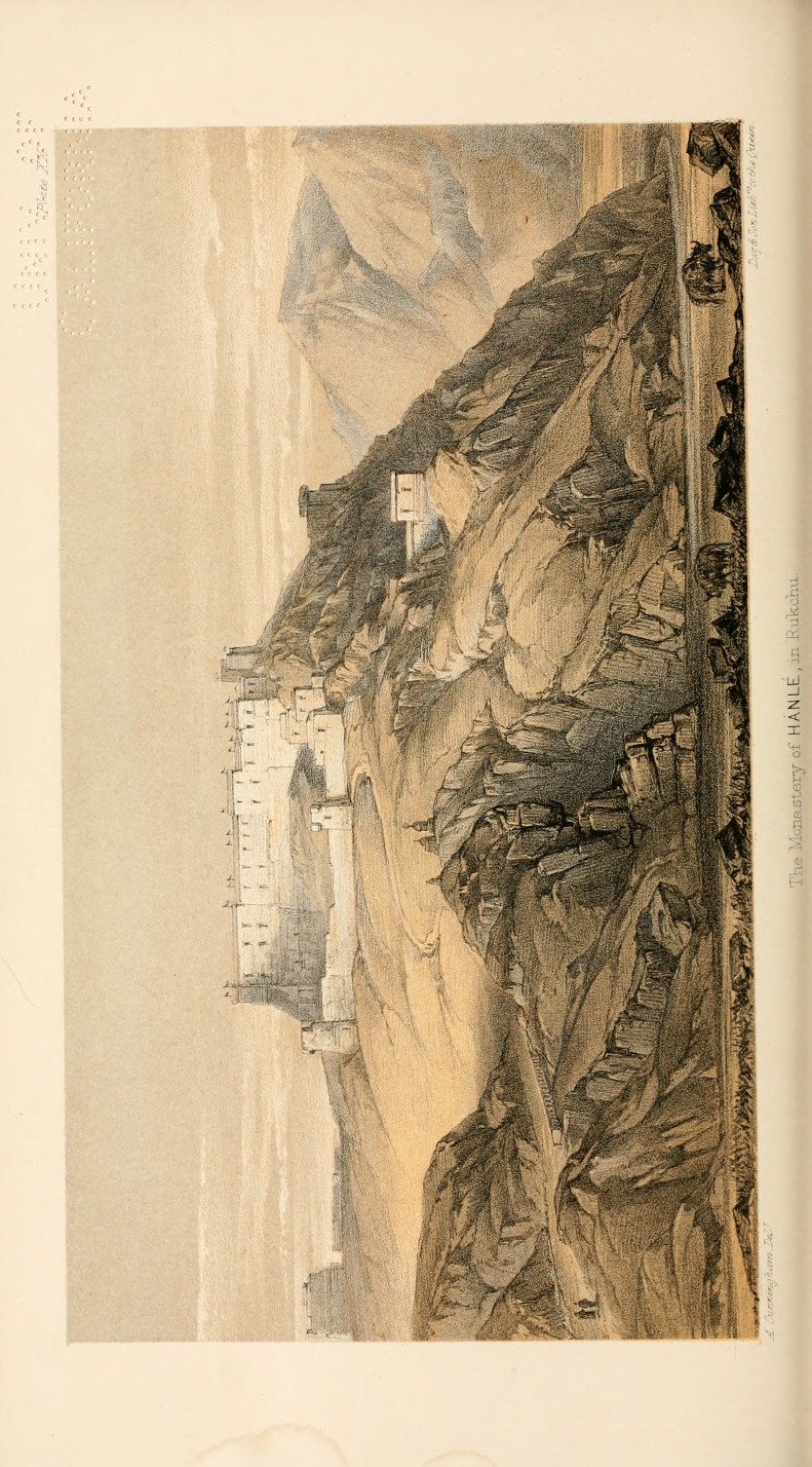
This movement toward systematisation is carried further in the work of Alexander Cunningham (1814–1893), whose Ladák: Physical, Statistical, and Historical (Cunningham 1854) assembles these strands into a comprehensive regional account. the volume is accompanied by a series of plates—maps and views, along with explanatory diagrams—that extend this effort, presenting the landscape not only as travelled but as documented and classified across multiple forms.
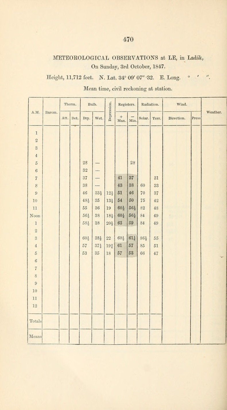
scaling up observation: the schalgintweits in ladakh
Across these decades, travel writing did not disappear, but it was increasingly supplemented, and at times displaced, by more ‘objective’ viewing practices of measurement and comparison. This gradual reorientation of observation reached a new scale in the work of the Schlagintweit brothers—Adolphe (1829–1857), Hermann (1826–1882), and Robert (1833–1885)—whose expeditions across India and High Asia in 1854 marked one of the most ambitious scientific undertakings in the region. Supported by the East India Company and influenced by the comparative methods of Alexander von Humboldt, the brothers set out to extend systematic measurement across the Himalaya and Karakoram (in addition to their work across the Indian subcontinent).
over the course of four years, they established an extensive network of meteorological stations (over 170 across the Indian subcontinent) collecting data on temperature and pressure, along with precipitation, at a range of elevations unprecedented for the time. what distinguishes their work is its scale and coherence: observations were standardised and coordinated, allowing for explicit comparison across sites to reveal vertical and regional climatic variation. In this sense, the Schlagintweits transformed earlier, more episodic observations into a structured programme of environmental measurement. Their findings were later compiled in the multi-volume Results of a Scientific Mission to India and High Asia (1861–66), which provided one of the earliest large-scale climatological datasets for the Himalaya. Building directly on the kinds of observations made by travellers such as Strachey and Cunningham, their work represents a decisive shift toward the systematic and instrument-based study of high-altitude environments (see Brescius 2021). Their publications were also accompanied by a rich body of visual material, including detailed depictions of glaciers and mountain landscapes, some of which are reproduced below.
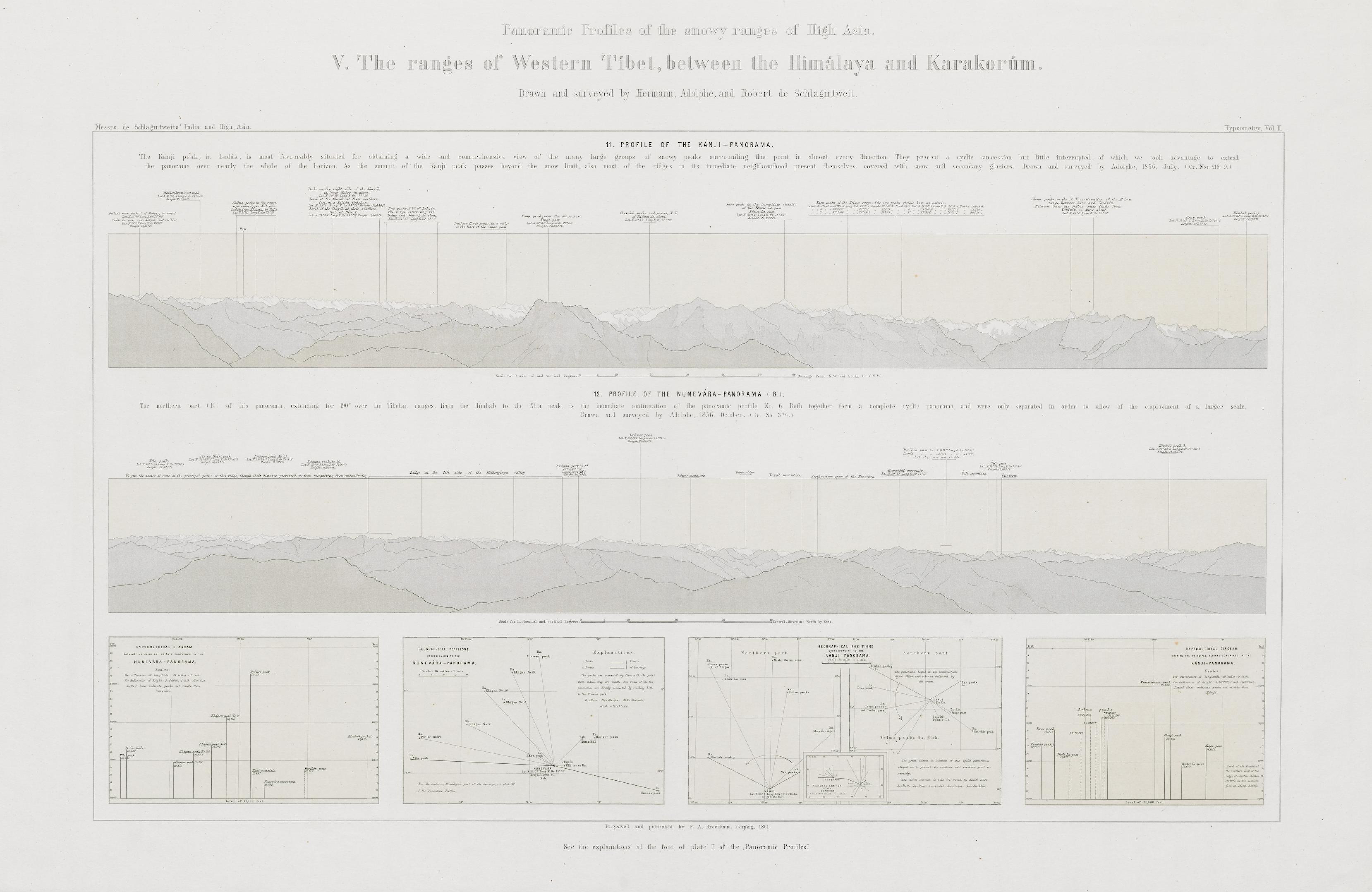
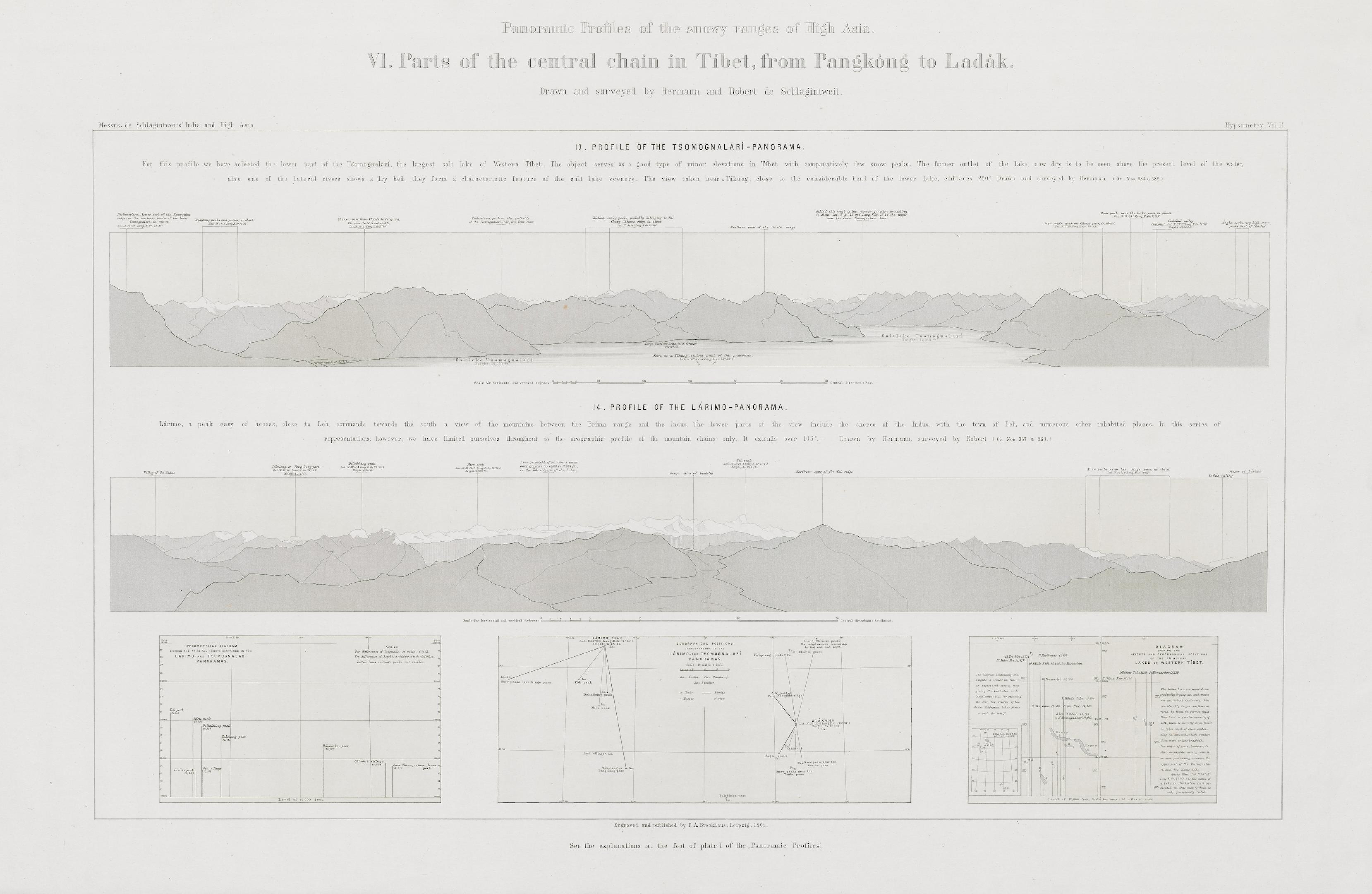
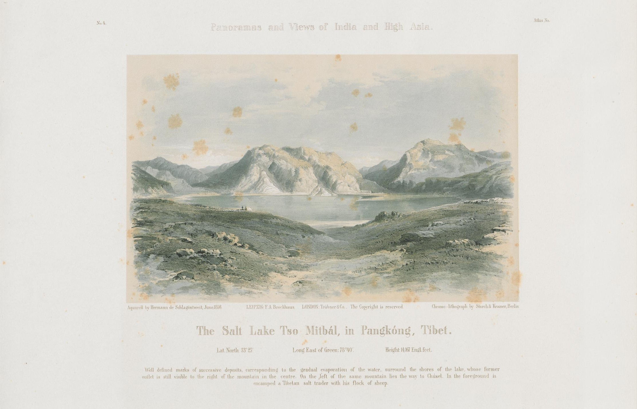
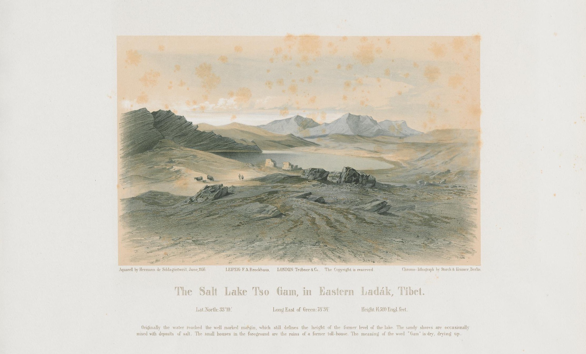
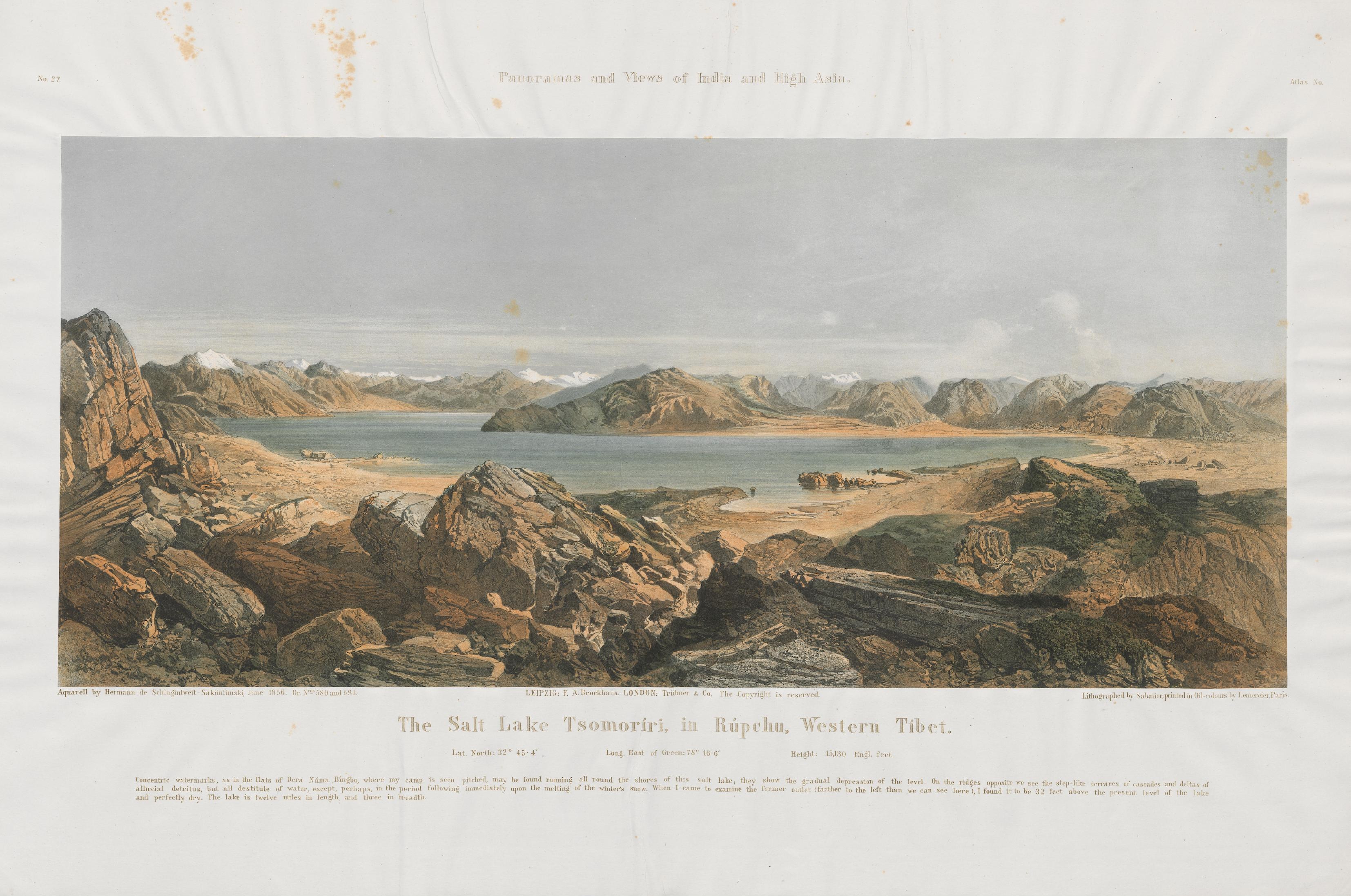
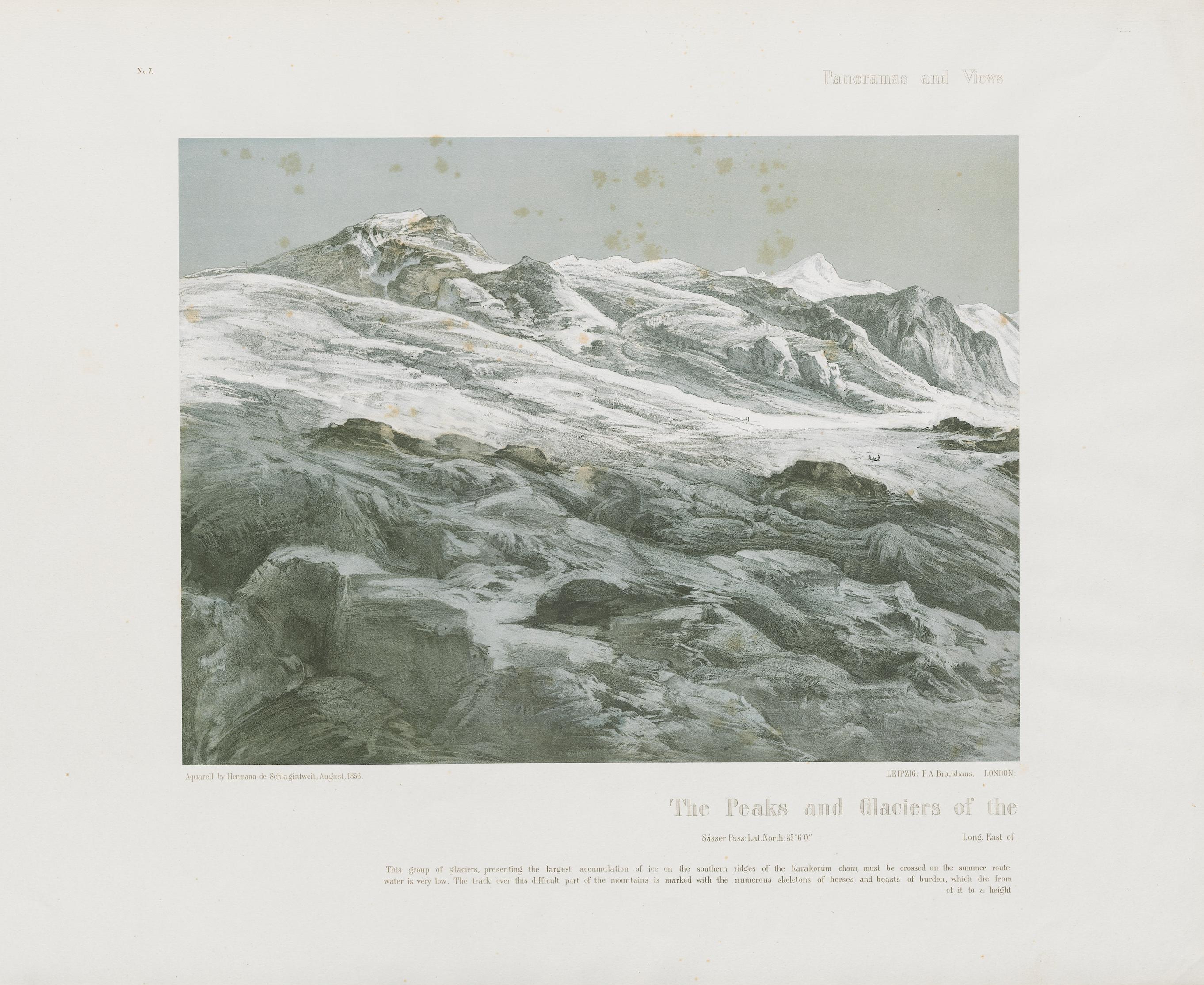
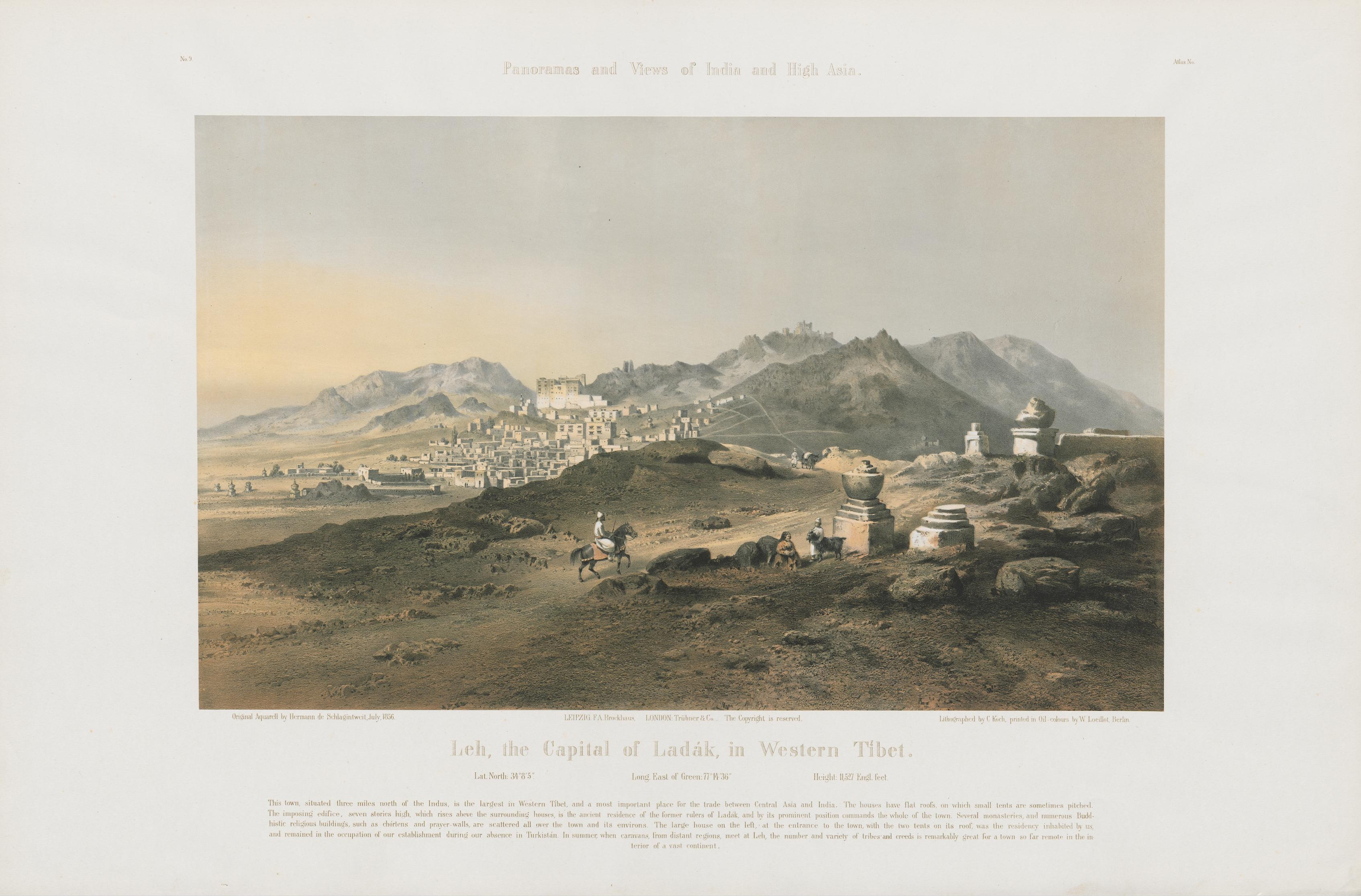
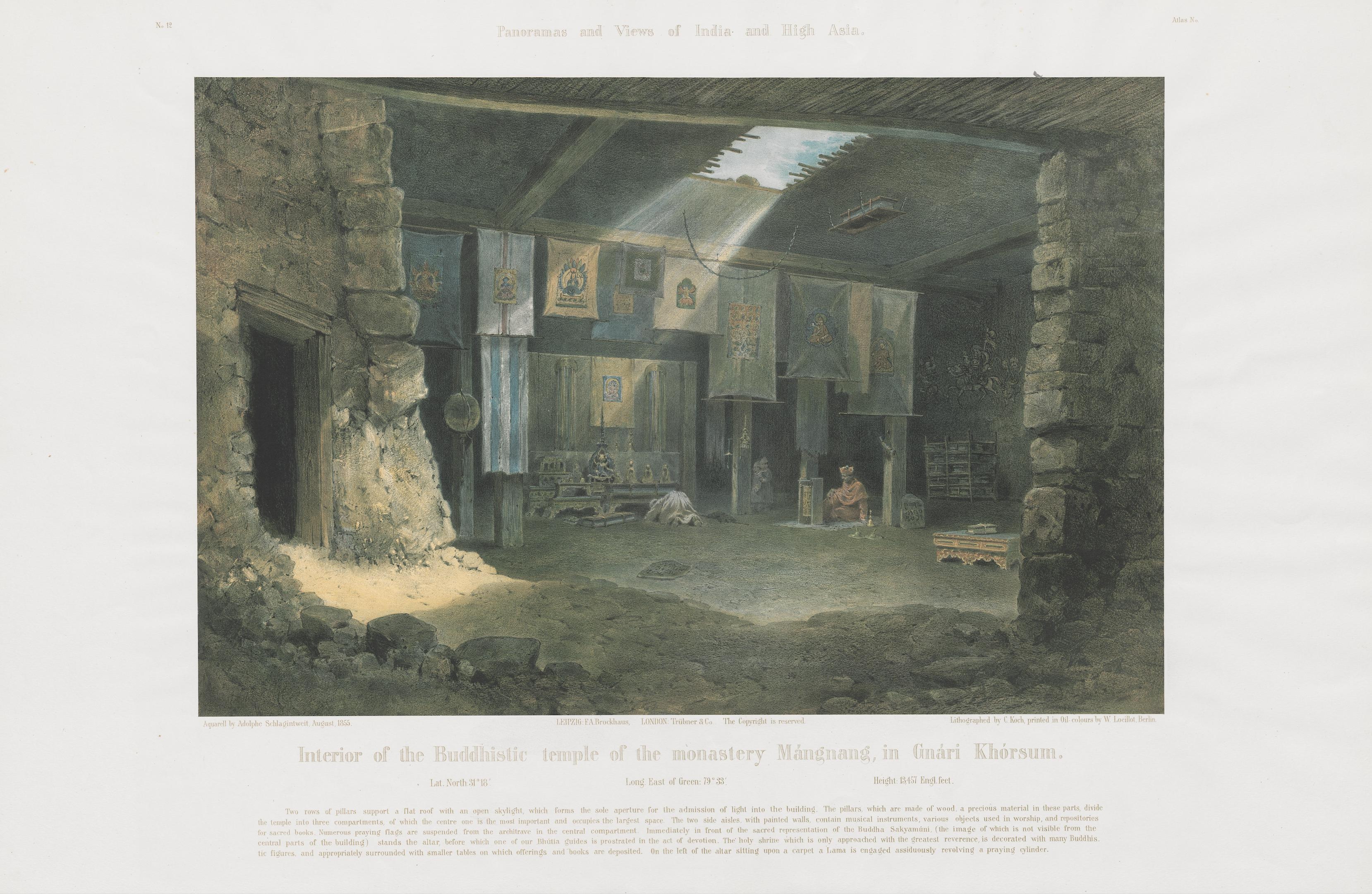
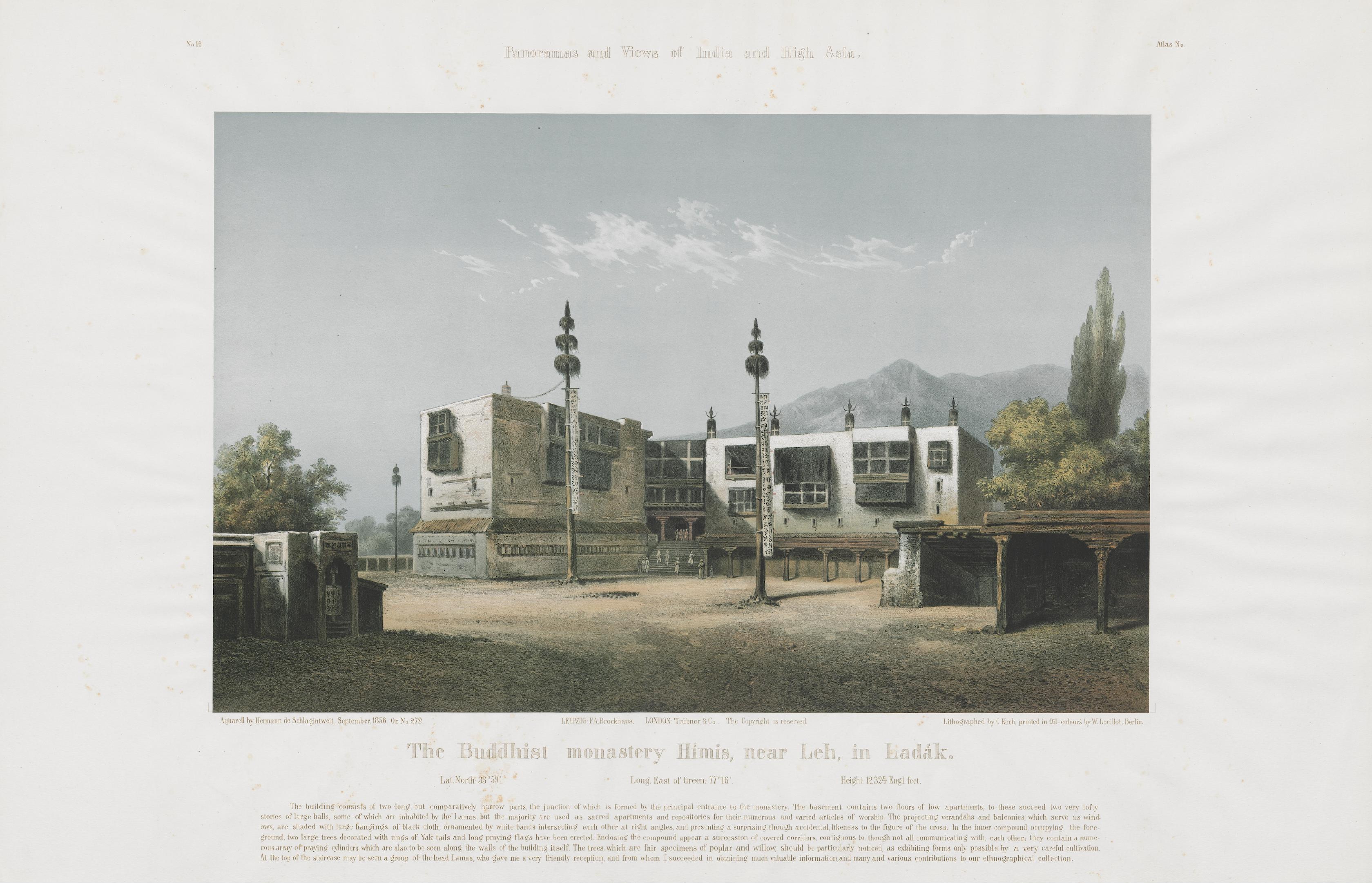
The significance of these observational networks becomes clearer in the work of John Bray, whose research has drawn sustained attention to the value of Moravian missionary records for reconstructing Ladakh’s climatic past (bray et al. 2024). Central to this effort are the detailed reports, letters, and meteorological observations preserved by Moravian missionaries, which provide rare continuity in a region otherwise marked by sparse and intermittent data. Bray’s account of Ladakh’s earliest meteorological observatory further illustrates how such records were produced and sustained (Bray 2020). The station in Leh, first established in the late 1870s under the British dispensary and transferred to Moravian supervision in 1887, formed part of a wider network initiated by Henry Francis Blanford (1834–1893), the Indian Meteorological Department’s first Meteorological Reporter. For Blanford, the expansion of reliable weather data—particularly from high-altitude regions—was essential to understanding broader atmospheric patterns, including the relationship between Himalayan snowfall and drought on the Indian plains (see Blanford 1884). In Leh, this ambition took material form in a modest but carefully equipped installation: a tower housing a barometer, topped with an anemometer to measure wind speed and direction, and complemented by thermometers and rain gauges installed within the mission compound.
how climate knowledge is made, and what can historians do
The operation of the station depended on a hybrid arrangement. While Moravian missionaries provided oversight, much of the day-to-day observational work was carried out by Ladakhi assistants, who took regular readings, often twice daily, and transmitted the results by post or telegram to regional meteorological offices. Over decades, this routine generated a continuous series of measurements, and linked Leh to a wider network of observation across the subcontinent. At the same time, missionary reports recorded associated phenomena viz. heavy rainfall, flooding, rapid snowmelt, allowing later researchers to correlate instrumental data with lived environmental events. This collaborative structure was not limited to meteorological practice alone, but extended into the production of knowledge more broadly. The work of Moravian missionaries in Ladakh (and Lahaul), including figures such as Heinrich August Jäschke (1817–1883) and August Hermann Francke (1870–1930), involved extensive linguistic and philological engagement with Tibetan, producing grammars and dictionaries, and numerous translations that made the region legible to European scholars. At the same time, the work of Emil Schlagintweit (1835–1904) drew directly on such materials, as well as on collaborations with local informants and intermediaries, showing how scientific work was shaped by other forms of knowledge, particularly linguistic and ethnographic, as historians of science now widely recognise. As recent scholarship has shown, even traditions that emphasised Wissenschaftlichkeit, i.e., a commitment to rigorous and ostensibly objective scholarship, relied in practice on a far wider range of locally grounded materials and collaborations than such an ideal might suggest (see Neuhaus 2026).
rather than existing as a purely abstract or text-bound mode of inquiry, knowledge production in this context took shape through shifting assemblages, emerging from the movement of people, materials, and practices across sites. linguistic work enabled scientific observation, while missionary records provided a basis for later climatological reconstruction, and forms of local knowledge, however unevenly acknowledged, remained embedded within both. what becomes visible here a process of co-production in which different ways of knowing were formed in relation to one another, through encounters that were at once practical, interpretive, mediated, and situated (to think about local situatedness, and the ‘geographies’ of scientific knowledge, one need only turn to david livingstone’s excellent work, putting science in its place).
Moreover, as Bray’s work suggests, the full potential of archival materials has yet to be realised. Substantial portions of the Moravian archive—housed in Herrnhut at the Unitätsarchiv of the Moravian Church—remain only partially explored, containing mission diaries, correspondence, and meteorological tables spanning decades of observation. Systematic digitisation and analysis of these records would make it possible to trace climatic variability in Ladakh with far greater resolution, extending the reach of historical climatology while foregrounding the local and institutional practices that sustained these observations. A similar case can be made for the extensive collections associated with the Schlagintweit brothers, whose manuscripts, maps, visual materials, and scientific data—dispersed across European archives—have yet to be studied in their entirety. Recent digital initiatives, including the Berlin-Brandenburg Academy project edition humboldt digital, have begun to make parts of this material more accessible (such as their letters to Humboldt), pointing to the possibilities of bringing these collections into wider scholarly circulation. This points to a clear imperative for sustained engagement with both missionary and scientific archives, not only to recover overlooked data, but to reconstruct longer climatic baselines in a region increasingly shaped by the pressures of global climate change, and to place present-day crises within deeper histories of environmental variability and human response.
this article makes a case for sustained archival work in ladakh, a region whose environmental histories remain only partially understood, and invites others to continue the task.
references
- blanford, henry f. 1884. “on the connexion of the himalaya snowfall with dry winds and seasons of drought in india.” proceedings of the royal society of london 37 (1884): 3–22.
- bray, john. 2020. “remembering ladakh’s first weather station.” stawa 7, no. 3 (2020): 1–5.
- bray, john, robert j. wasson, pradeep srivastava, and alan d. ziegler. 2024. “floods and debris flows in ladakh: past history and future hazards.” in environmental change and development in ladakh, indian trans-himalaya, edited by blaise humbert-droz, juliane dame, and tashi morup. springer nature switzerland. https://doi.org/10.1007/978-3-031-42494-6_3.
- brescius, moritz von. 2021. “empires of opportunity: german naturalists in british india and the frictions of transnational science.” modern asian studies 55, no. 6 (2021): 1926–71. https://doi.org/10.1017/S0026749X19000428.
- cunningham, alexander. 1854. ladak, physical, statistical, and historical; with notices of the surrounding countries. london: w. h. allen and co.
- shafiq, m., m. s. bhat, r. rasool, p. ahmed, h. singh, and h. hassan. 2016. “variability of precipitation regime in ladakh region of india from 1901–2000.” journal of climatology & weather forecasting 4, no. 2 (2016). https://doi.org/10.4172/2332-2594.1000165.
- moorcroft, william, george trebeck, and h. h. wilson. 1841. travels in the himalayan provinces of hindustan and the punjab, in ladakh and kashmir, in peshawar, kabul, kunduz and bokhara: from 1819 to 1825. 2 vols. london: john murray.
- neuhaus, tom. 2026. “diligent germans with a thirst for knowledge? emil schlagintweit, german orientalism, and nineteenth-century tibetology.” central european history, january 9, 2026, 1–22. https://doi.org/10.1017/S0008938925101386.
- nüsser, marcus, and ravi baghel. 2016. “local knowledge and global concerns: artificial glaciers as a focus of environmental knowledge and development interventions.” in ethnic and cultural dimensions of knowledge, edited by peter meusburger, tim freytag, and laura suarsana. springer international publishing. https://doi.org/10.1007/978-3-319-21900-4_9.
- strachey, henry. 1854. physical geography of western tibet. london: printed by william clowes and sons.
- thomson, thomas. 1852. western himalaya and tibet: a narrative of a journey through the mountains of northern india, during the years 1847–8. london: reeve and co.
- vigne, godfrey thomas. 1842. travels in kashmir, ladak, iskardo, the countries adjoining the mountain-course of the indus, and the himalaya, north of the panjab. 2 vols. london: h. colburn.