nainital is a hill station on the southern slopes of the kumaon himalaya, in present-day Uttarakhand, with Nepal to the east and Tibet to the north beyond the higher himalayan ranges. it is, at its simplest, a town organised around a lake in the mountains. established in the mid-nineteenth century as a british sanitarium, it lies at an elevation of roughly 6,300 feet above sea level. the lake itself sits within a steep, basin-like hollow, with ridges rising sharply on all sides so that the settlement appears held within the surrounding hills rather than spread across them. these slopes are dominated by banj and tilonj oak, alongside himalayan cypress and deodar, with a dense undergrowth that includes wild berberry, himalayan musk rose, common sage, and urtica parviflora—the notorious stinging nettle that thrives wherever it finds purchase. the kumaon region in which this landscape lies has, over time, fallen under different regimes of political control.
 click to expand
prior to the nineteenth century, kumaon was ruled from Almora by the chand rajas (see Agarwal 1993), and the lake at nainital appears in later records as part of a sacred local landscape rather than an administrative one. british scholar-official henry r. nevill, who compiled several official gazetteers, including the nainital gazetteer in 1904, records that local communities “resorted hither for bathing in the lake, which was the special property of the goddess” (nevill 1904, p. 307), preserving both its ritual use and its association with the goddess sati (or parvati), whose eyes (nain) are believed to have given the lake its name. this sacred and political order was disrupted in the early nineteenth century by the expansion of gorkha rule into kumaon, described in colonial accounts in very severe terms:
“Grievous offences against the Hindu religion and system, such as the wilful destruction of a cow or the infringement of caste distinctions by a Dom—for example, knowingly using a hukka or any other utensil belonging to a Rajput or Brahmin—were also capital. The mode of inflicting capital punishment was either by hanging or beheading; the Gorkhas introduced impaling and sometimes put convicts to death with the most cruel tortures.” (Batten 1851, p. 28).
among the more detailed contemporary observers was artist and himalayan traveller James Baillie Fraser (1783–1856), who travelled through the wider himalayan region during the anglo-nepalese war and left both written and visual records of the landscape and its people (fraser 1820, see part I on the Anglo-Gorhka War). these materials, including his drawings, were brought back into wider circulation through the work of Mildred Archer and Toby Falk in india revealed (archer and falk 1989), which has recently been explored in greater depth (Joshi 2025).
at the conclusion of the Anglo-Gorkha War, and the signing of the treaty of sugauli in 1816, kumaon found itself entangled in what has been described as the East India Company’s “tentacles of progress” (Headrick 1988).
following the incorporation of kumaon into british territory, the EIC’s attention turned to the systematic description and measurement of the region. among the earliest and most significant of these efforts was that of George William Traill (fl. 1792–1847) who, as commissioner, produced the statistical sketch of kumaon published in volume 16 of asiatic researches. within this account, the lake at nainital is mentioned as one among several “remarkable” lakes of the landscape, including Bhimtal and Naukuchiatal, already noted within the course of administrative observation (Traill 1828, p. 139); related manuscript material, including traill’s reports on early police administration, is preserved in the British Library under the reference ior/f/4/1159/30397 (1823–1826). subsequent survey work continued in a similar vein. william webb (1784–1865), writing in the journal of the royal geographical society, recorded “nynee tal” in his tabulation of altitudes (webb 1834, p. 22), situating it within a broader effort to measure and catalogue the terrain. this reference formed part of a longer trajectory of survey work. webb had earlier traversed the region during his expedition to the headwaters of the ganga in 1808, producing a route map in 1810 in which nearby lakes such as bhimtal and naukuchiatal, both in close proximity to nainital, are clearly marked. webb’s associate, the anglo-indian condottiere and explorer Hyder Jung Hearsey (1782–1840), produced a painting of naukuchiatal in 1815, indicating that these lake sites had already entered the field of visual representation. in webb’s later map of kumaon, published in 1819, nainital itself is clearly marked, and thus incorporated into an increasingly detailed cartographic record of the region.
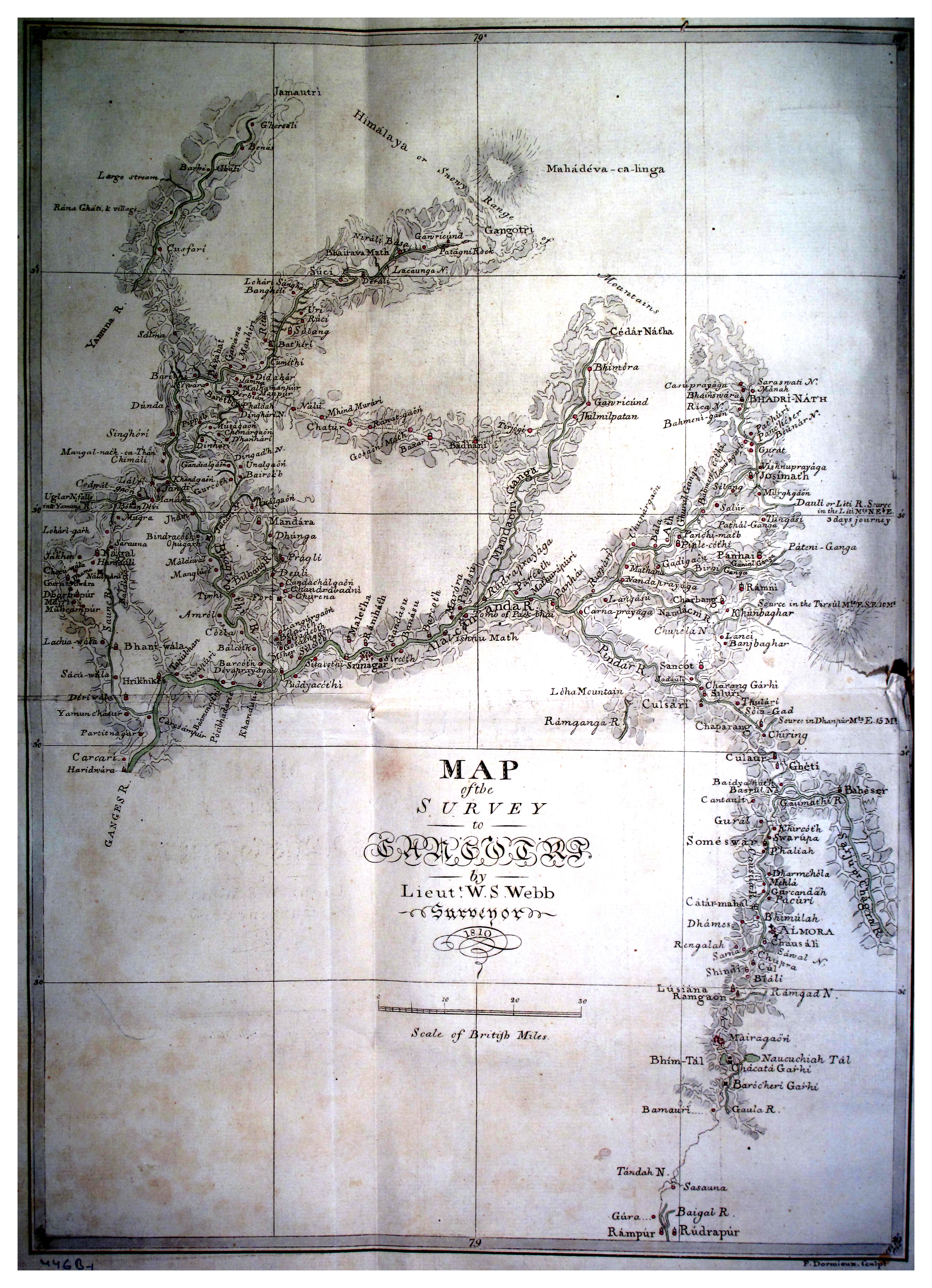
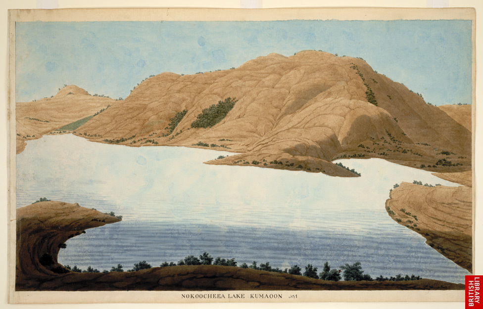
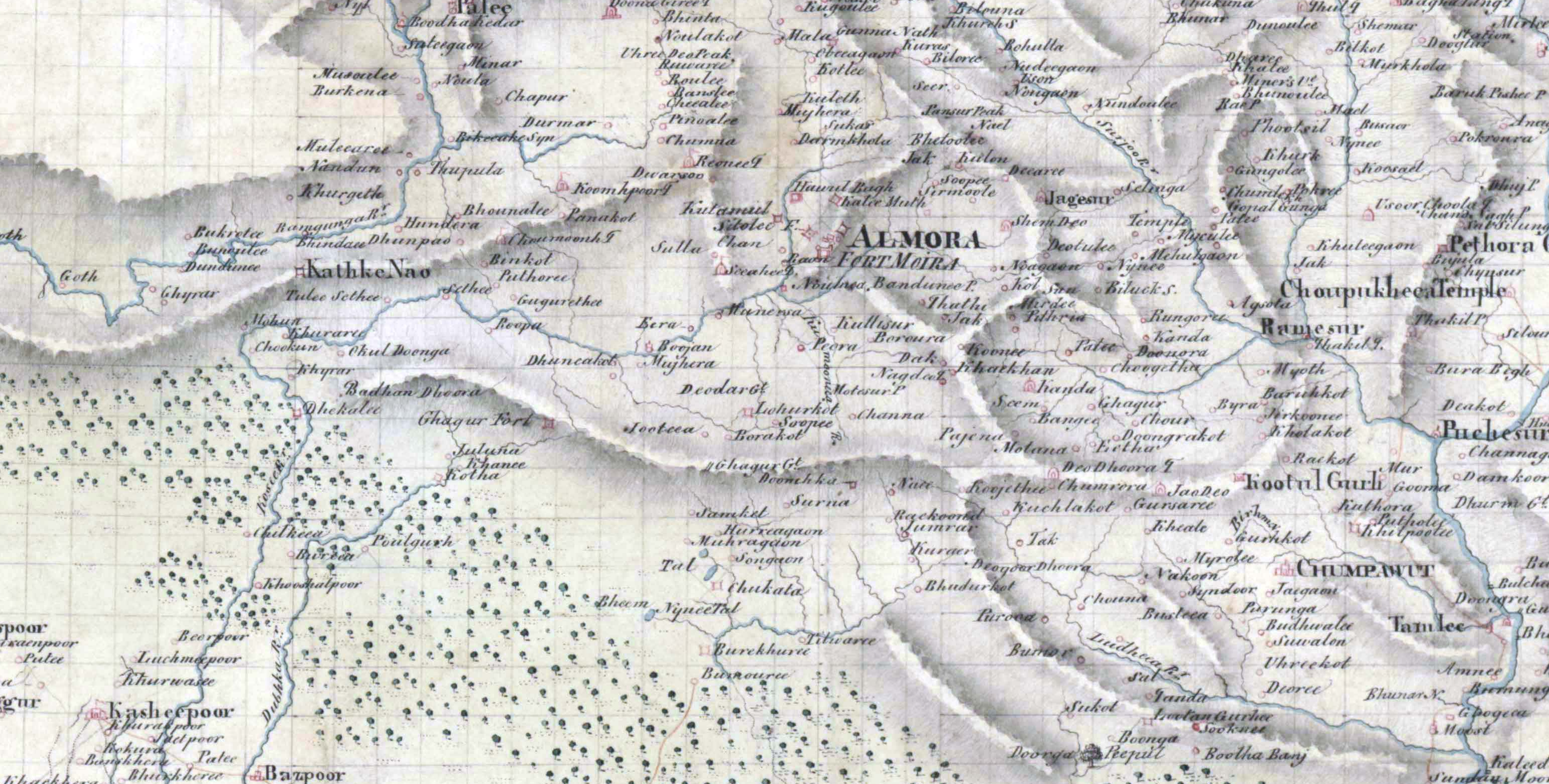
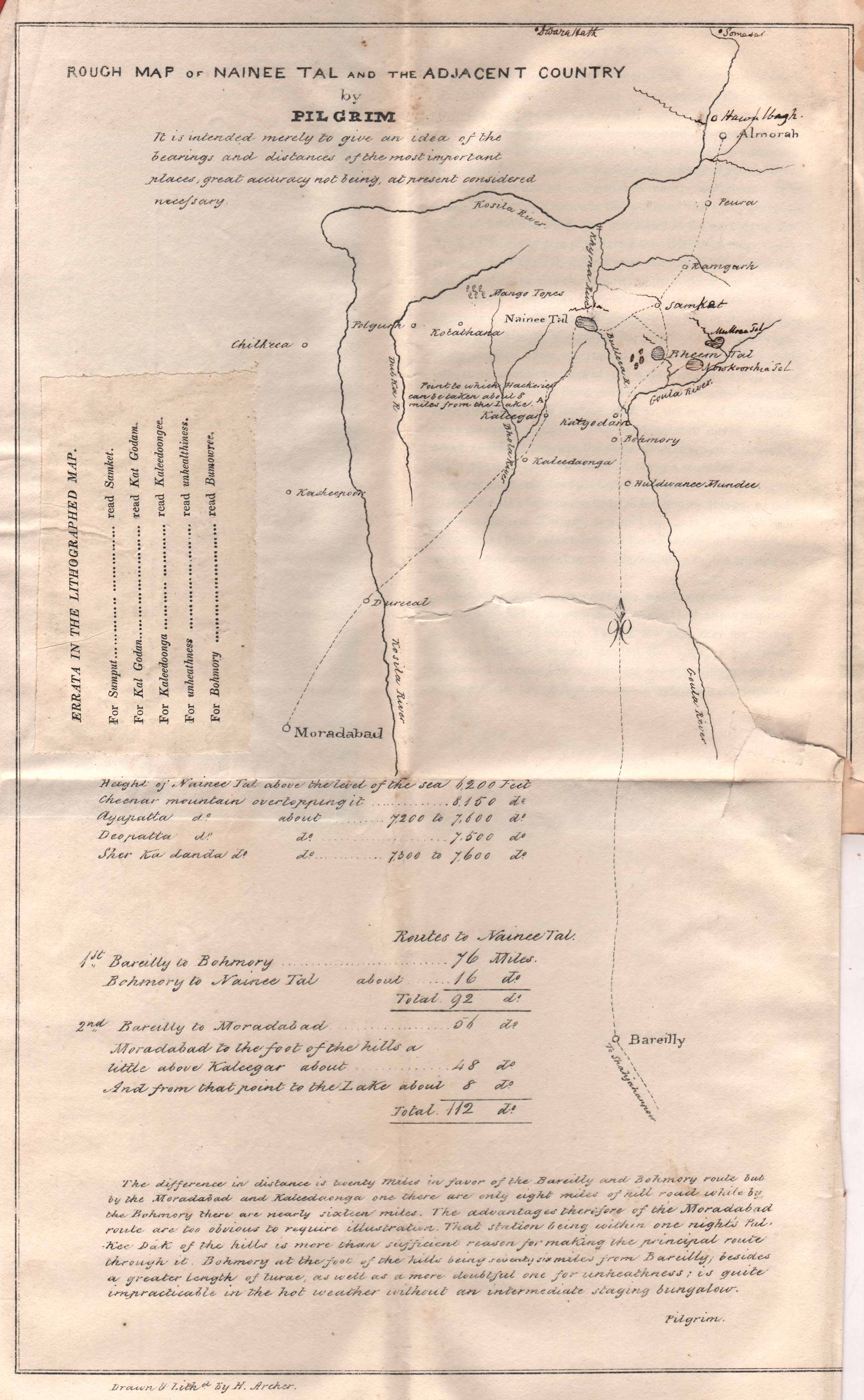
these early references indicate that the site was known within both official and local contexts prior to 1841, the year that later came to be popularly identified as its “discovery.” it was in that year that P. Barron—a sugar trader from Saharanpur, writing under the name “pilgrim”—published his account of reaching the lake, portraying it as a newly revealed site suitable for the establishment of a european sanitarium.
pilgrim barron dwells at length on what he calls nainital’s “extraordinary recommendations,” listing “abundance of wood, of the finest water, of level ground… capabilities for miles of beautiful roads,” and “a magnificent sheet of water both for ornament and for use,” before asking why such a site had not been selected for a sanitarium instead of the “bleak hills and rugged precipices of landour and mussooree.” this sense of oversight is accompanied by a pointed criticism of earlier officials. barron singles out George William Traill (fl. 1820s), suggesting that he “did his best to conceal the existence of such a place as nainee tal from all europeans,” and characterises this as part of a broader tendency among certain British administrators to jealously guard access to the hill regions. he extends this criticism to frederick shore (1799–1837) in the doon, who allegedly described the influx of europeans to established hill stations mussoorie and landour as “a public calamity” and even “a pindaree invasion.” barron further suggests that orders were given to prevent the nainital lake from being revealed to europeans, instructions which, as notes, were “peculiarly agreeable” to the wishes of the hill people themselves. accordingly, his party “shewed the greatest reluctance to guide us to the lake, by pleading entire ignorance of its locality,” even though it was “as well known to all the hill men as the fact of the sun shining at noon day” (barron 1844, p. 25–27).
 click to expand
the circumstances of barron’s arrival further complicate his account of “discovery.” he notes that his party travelled with “a most unwilling guide,” who repeatedly claimed not to know the way to the lake. barron, however, treats this ignorance as deliberate concealment. suspecting that the guide was misleading them, he describes using “something like gentle violence” to force the issue. his chosen method was what he calls “the excellent plan of giving him a heavy stone to carry, till he could discover the right [direction].” the ruse depended on a simple claim: the guide was told that the stone had to be carried to nainee tal, “where there are no stones.” under the burden, and in the hope of being relieved of it, the guide protested that there were in fact stones at the lake. for barron, this admission was decisive, since it implied prior knowledge of the place he had just denied. the episode is presented as a practical “recipe” for dealing with guides who profess ignorance, and is accompanied by his broader claim that “the hill men are generally great simpletons” and “very egregious block-heads” (barron 1844, p. 27–28). read closely, however, the passage records not ignorance but resistance, and a situation in which local knowledge is extracted under pressure rather than freely offered.
the establishment of Nainital as a colonial settlement followed swiftly upon its framing as a site suitable for european occupation. in february 1842, Barron applied to the assistant commissioner of kumaon John Hallet Batten (fl. 1830s–1840s) for a “a lease of land, on the banks of the lake … known by the name of nynee tal,” seeking “sufficient land for the site of a house and a garden; with a little to spare for any other out buildings” (Barron 1844, p. xiv; see also Tolia 2009). the application was forwarded by batten with evident support, and the colonial administration moved quickly from formal possession to planned development. officials in the north western provinces advised that grants should be regulated, with land reserved for “public purposes, such as fairs, markets, bazars,” as well as for “public buildings, as a church” (Barron 1844, p. xviii). within a few years, this framework had taken material form. by 1847, the then commissioner george lushington reported that forty houses had been constructed, that “sixty-one visitors had resided there during that season … and twenty-six casual visitors had at different times come up to the lake” between march and august (lushington 1847, cited in maitreyee 2018). over the following decades, this initial settlement expanded into the institutional and social infrastructure characteristic of a hill station—residences, barracks, schools, hospitals, clubs, and the mall—laid out across terrain officially described as “unoccupied and waste, and entirely at the disposal of government” (elliot 1842–43, cited in maitreyee 2018). the term “discovery,” initially deployed as a legal and rhetorical device to displace prior claims, gradually hardened into received history, so that by the time of nevill’s gazetteer the site could be described as having been “apparently unknown” before 1841 (nevill 1904, p. 307).
nainital in view: images across the nineteenth century
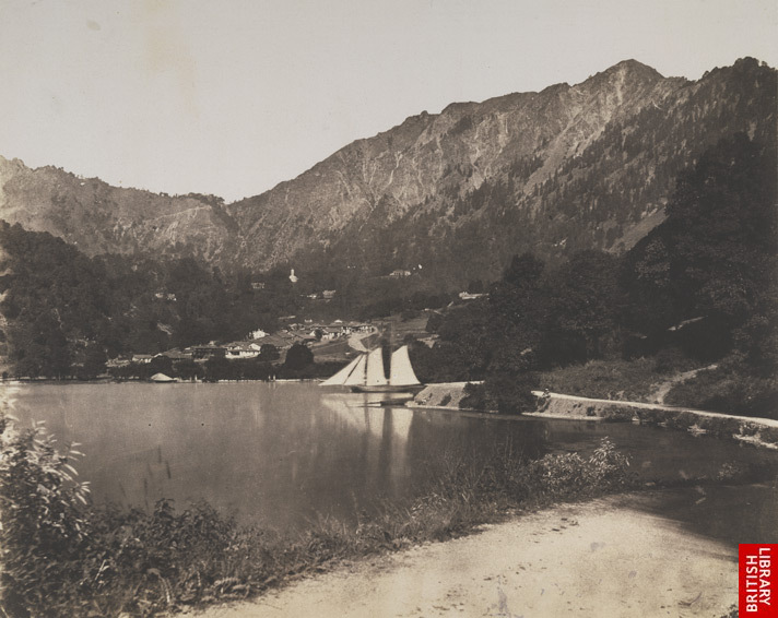
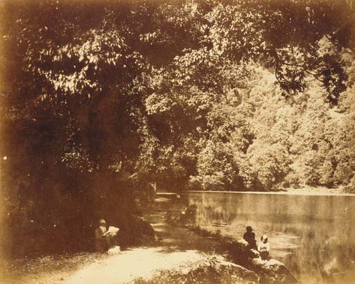
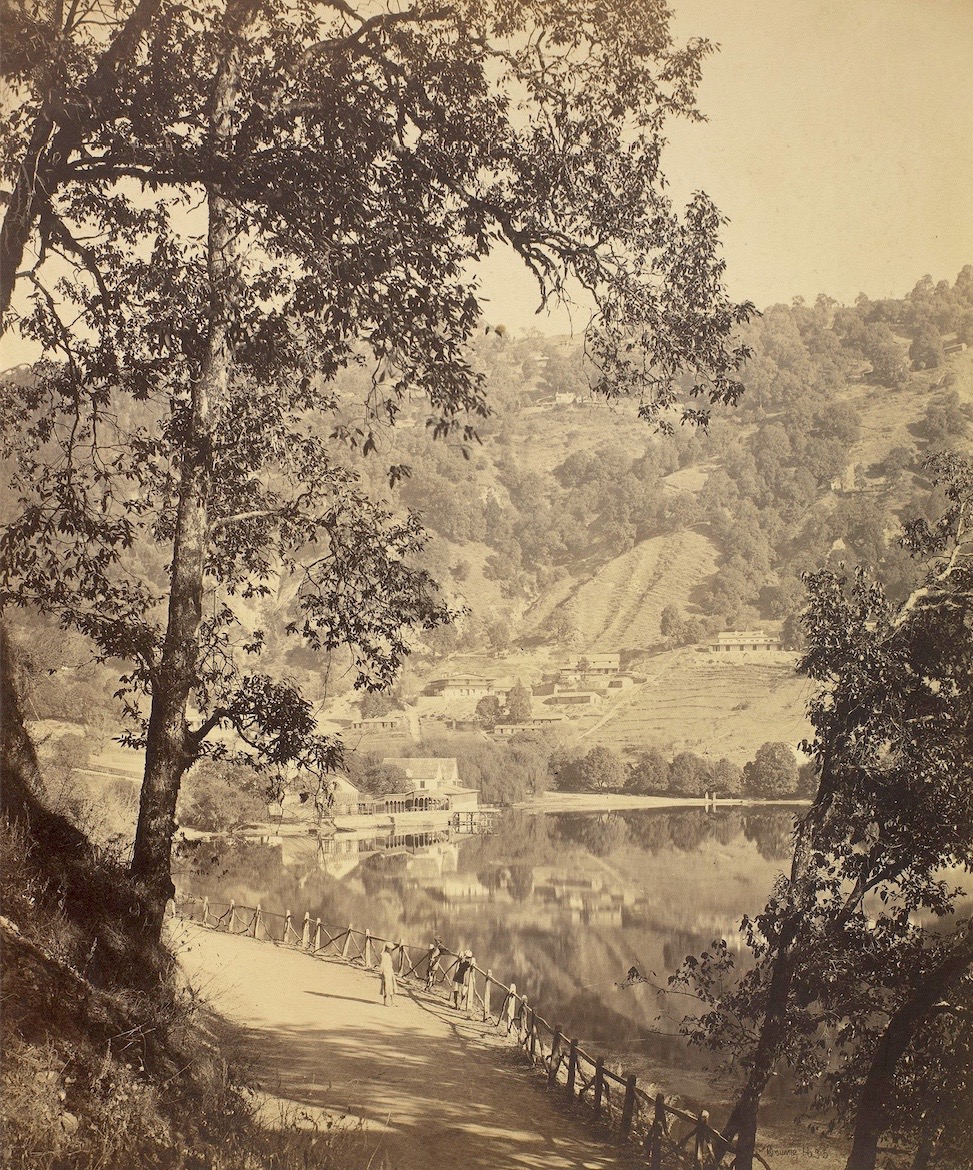
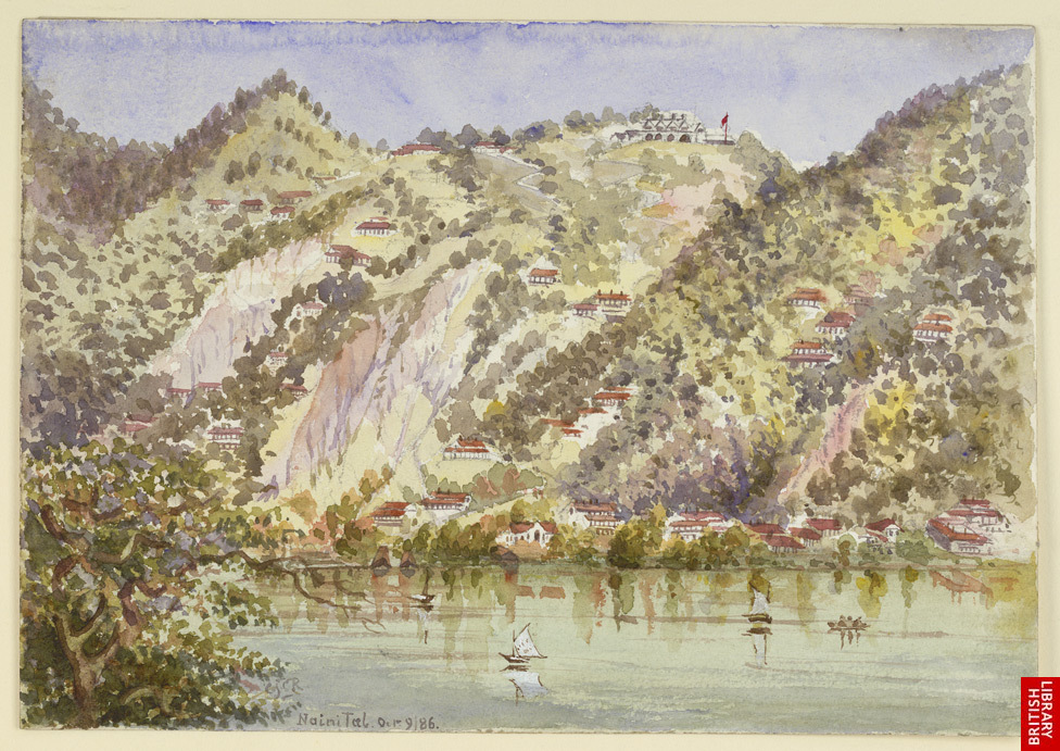
for many viewers, Nainital is most readily recognised through nineteenth-century photographs, beginning with those of John Murray (1809–1898), whose views of naini tal date to the mid-1850s, followed by John Edward Sache (1824–1882), active in india from the 1860s, and later Samuel Bourne (1834–1912), who worked in the region between 1863 and 1870. beyond these familiar images, however, the lake and its surroundings persist in a wider but less circulated visual record: postcards, engravings published in illustrated newspapers, as well as paintings and field sketches produced by travellers and naturalists moving through the himalaya. across the nineteenth century, these materials accumulate unevenly, often overlapping and not always consistent in emphasis or naming—appearing as nainee tal, nyneetal, and eventually stabilising as nainital. having considered maps and sketch-based representations above, what follows is a non-exhaustive survey of key photographs, paintings, and postcards up to c. 1900.
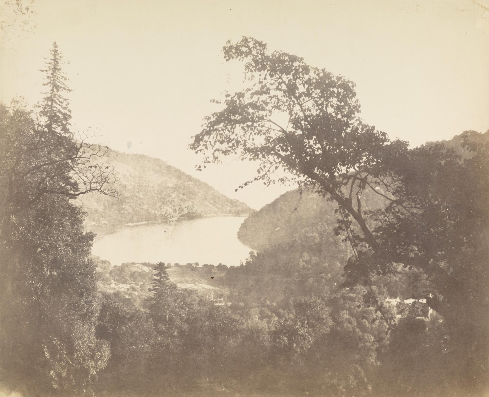
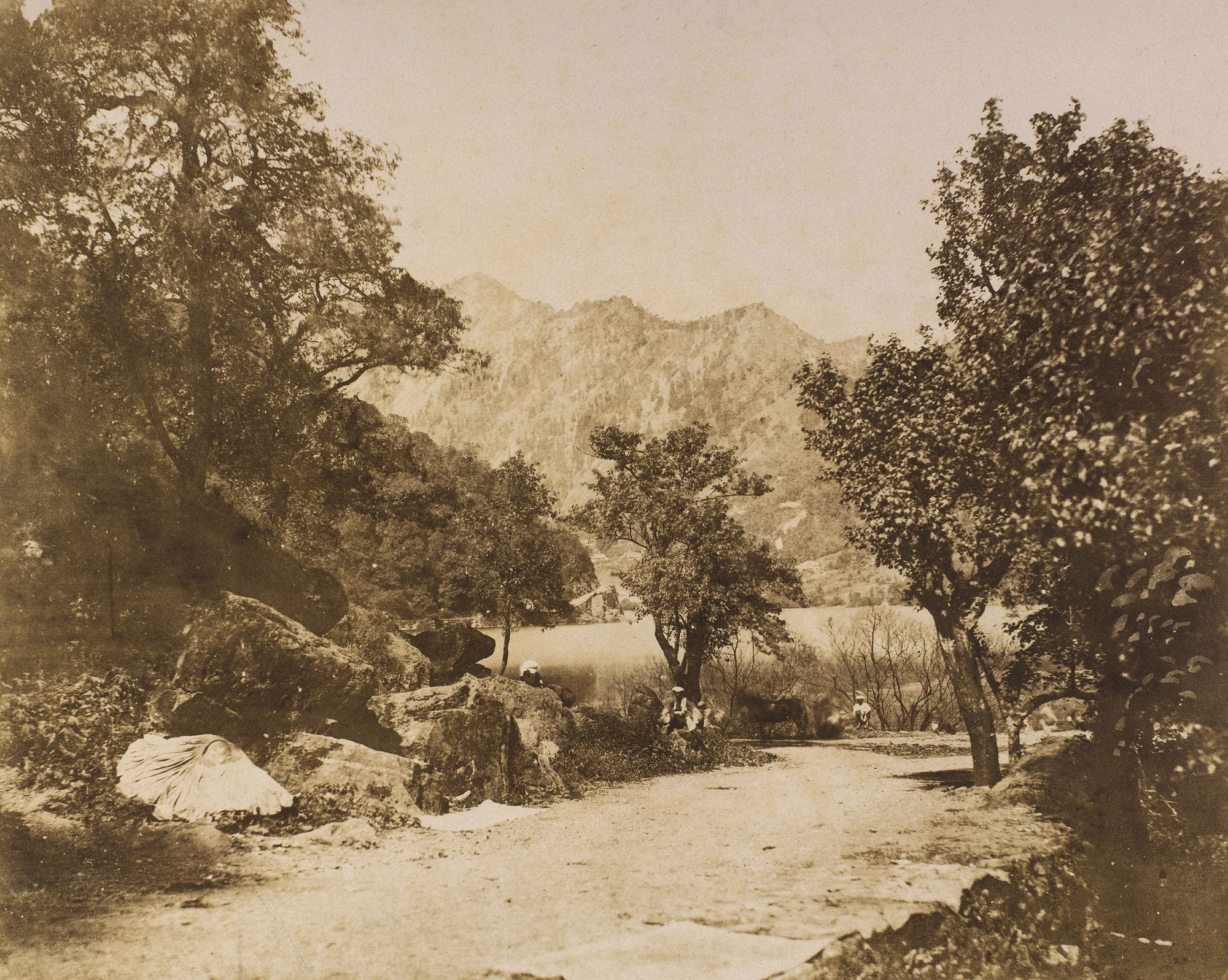
among the earliest photographers to work in Nainital was John Murray (1809–1898), a physician in the East India Company’s medical service who served for decades in north india, including as civil surgeon at agra. from this posting, he travelled periodically to the kumaon hills, where nainital had already begun to function as a small administrative and social centre by the late 1840s. murray began making photographs in 1849, working with the waxed-paper calotype process, and returned to nainital across multiple visits over the following decade and a half. his earliest views of the lake date from the early 1850s, when he was still refining the technique; by the later 1850s and early 1860s, he was producing large-format negatives, often around 38×47 cm, which he printed as albumen photographs. several of these survive, including carefully worked views of the lake and its wooded slopes, and a rare image of murray himself seated by the water with a book and dog, taken between about 1858 and 1862. his practice also included the selective application of pigment to negatives, a method used to deepen tonal contrast in areas of foliage and reflection. photographs dated as late as 1866 indicate that he continued to return to nainital toward the end of his service.
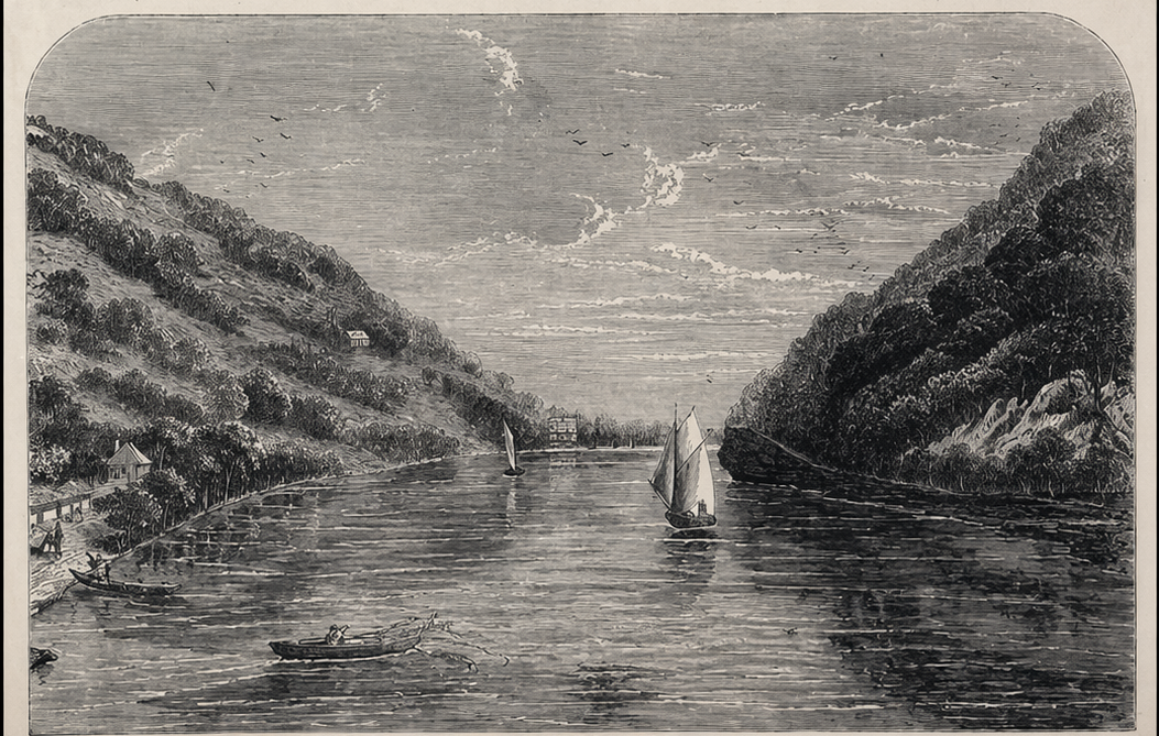
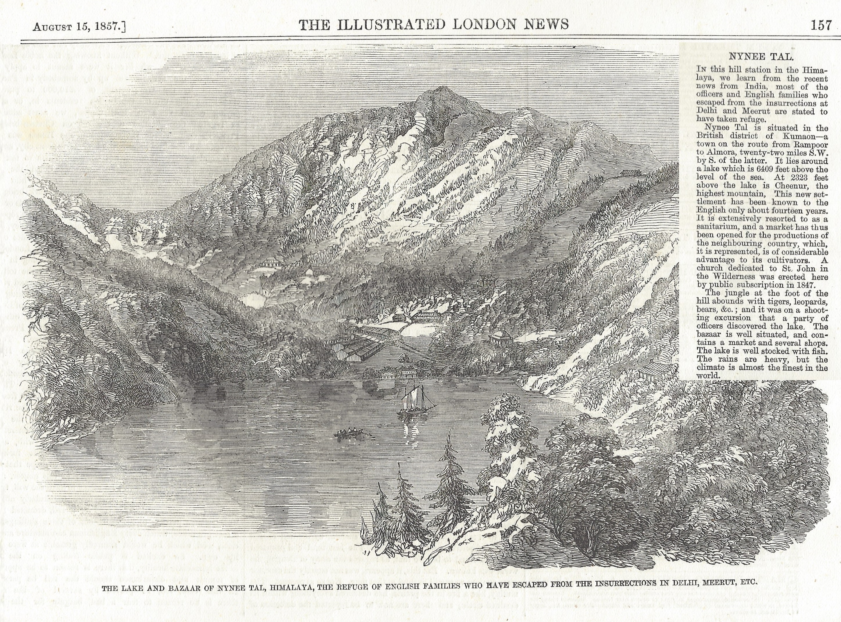
around the same time that John Murray was active in Nainital, two illustrated periodicals from 1857 offer another view of the place. in the context of the Indian Rebellion of 1857, hill stations such as nainital appear in engravings as places of relative safety, removed from the disturbances of the plains. the lake is shown as calm, with houses set along its edge and the surrounding hills enclosing the settlement. these images circulated at a time when the plains were unsettled, and they helped fix the hills in the imagination as spaces of retreat.
following John Murray, John Edward Sache (1824–1882) appeared in nainital. born johann edvart zachert in prussia, he worked in the united states before arriving in calcutta in 1864, where he entered into partnership with w. f. westfield. by 1867, he had set up a summer studio in nainital, alongside a winter base in lucknow, becoming the first photographer to maintain a regular commercial presence in the hill station. his output from nainital alone ran to several hundred large-format plates, typically around 10×12 inches, and forms one of the most extensive visual records of the town in the later nineteenth century. these images move beyond the earlier, more occasional views and instead document the place as it developed, recording its buildings, roads, and lake from multiple vantage points. sache’s work was not limited to landscape; he also photographed architecture across north india and, in a less common practice for the period, produced photographic studies of insects. by the 1870s, his operations had expanded further to include additional studios in cities such as meerut, kanpur, and benares.
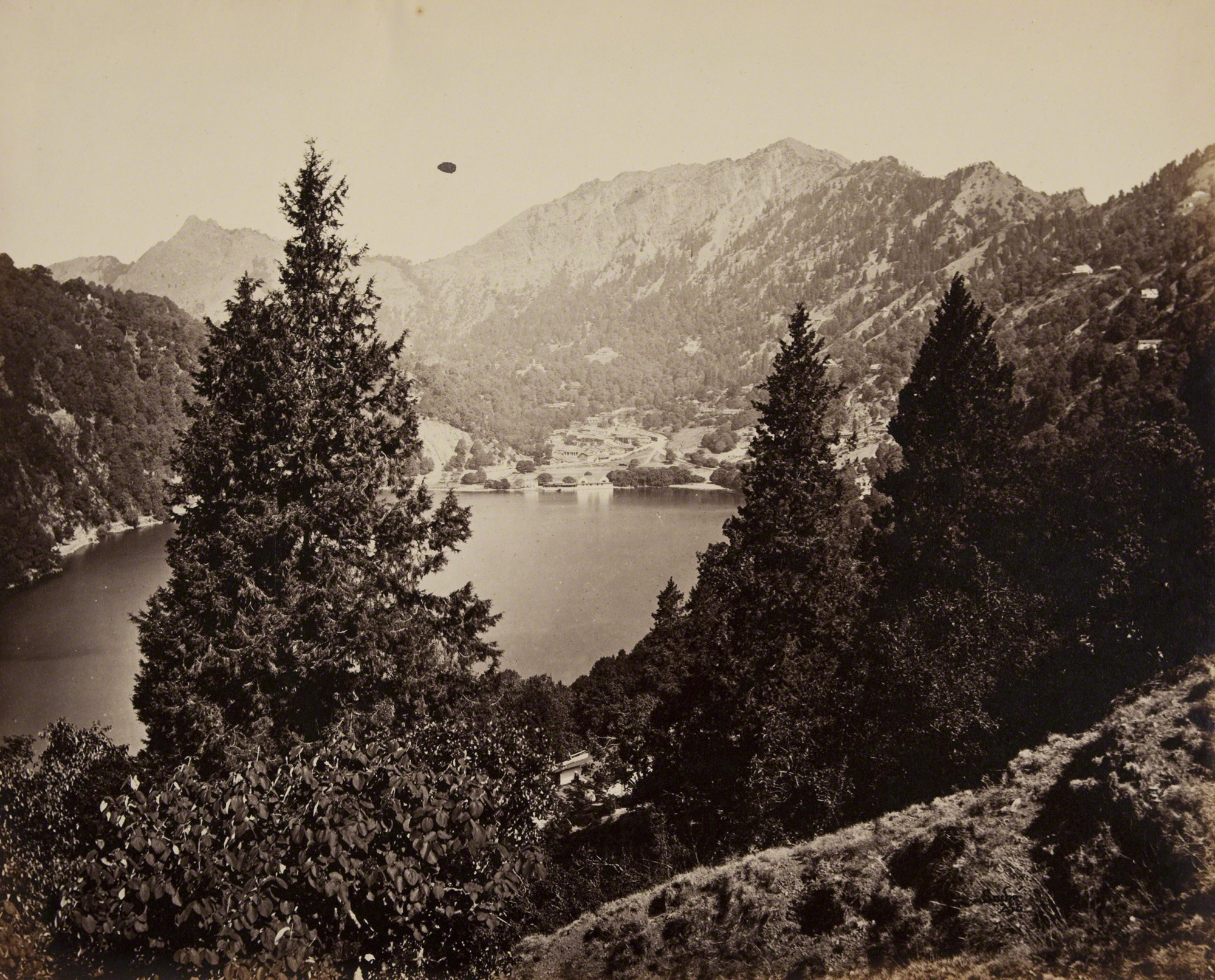
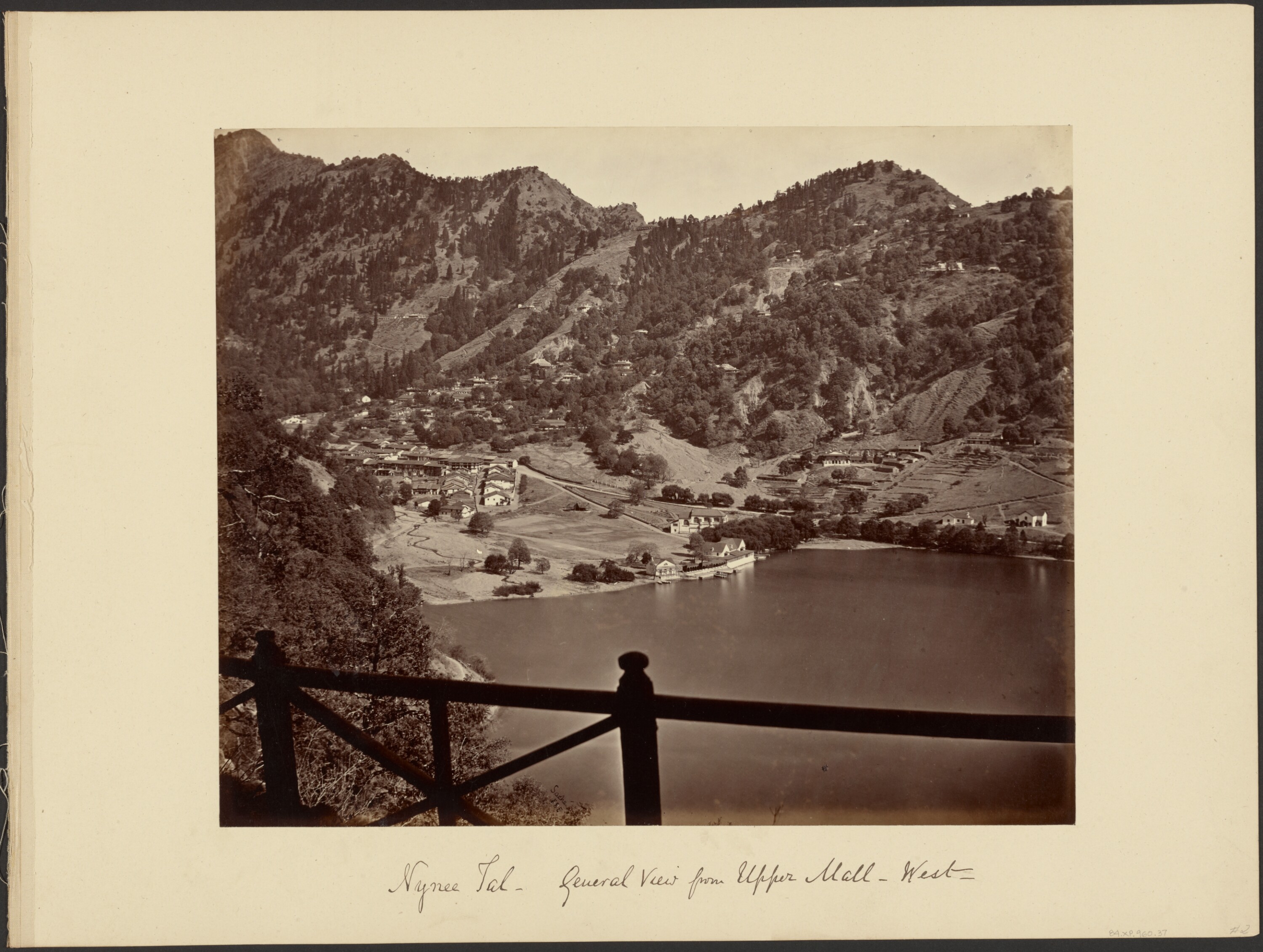
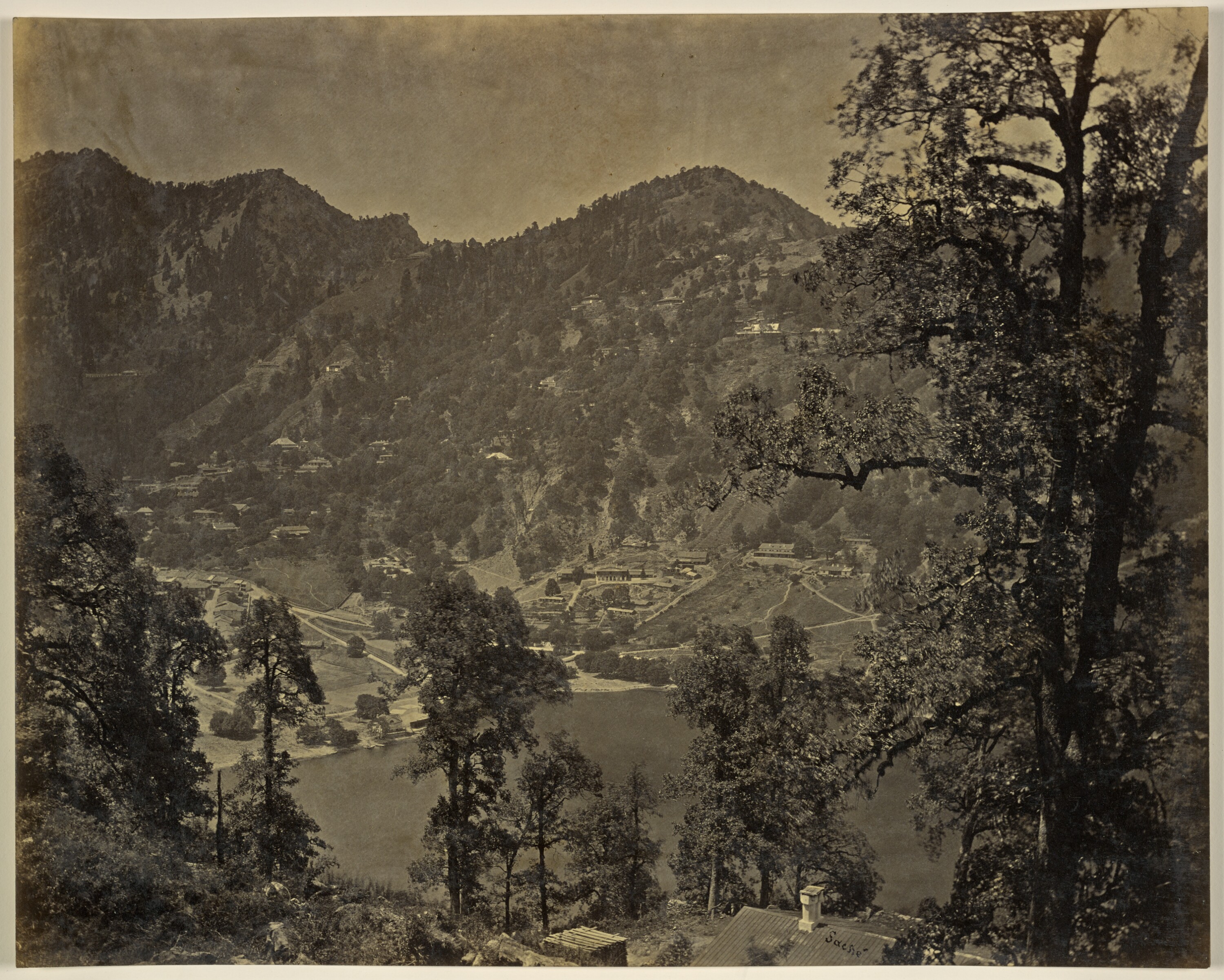
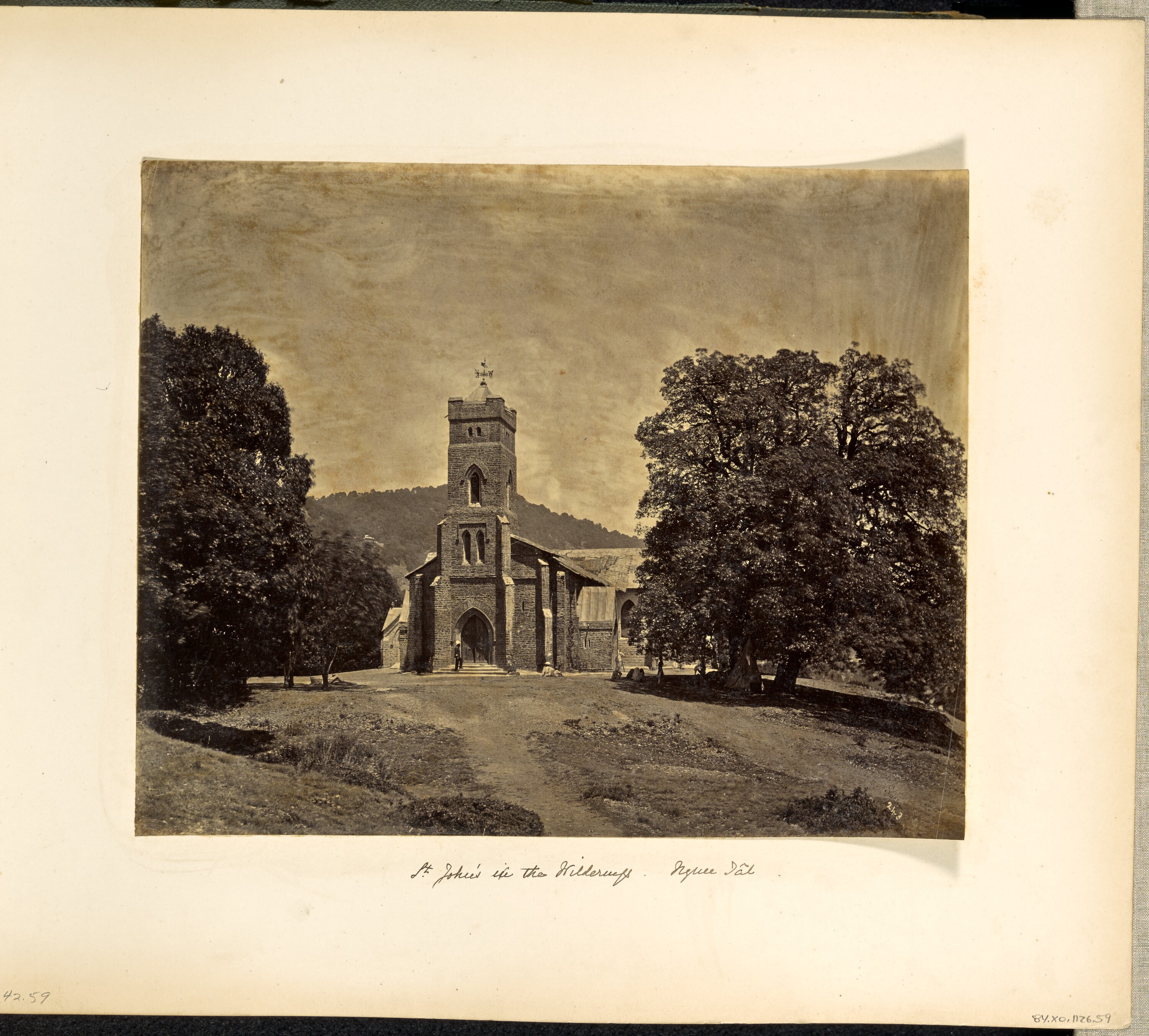
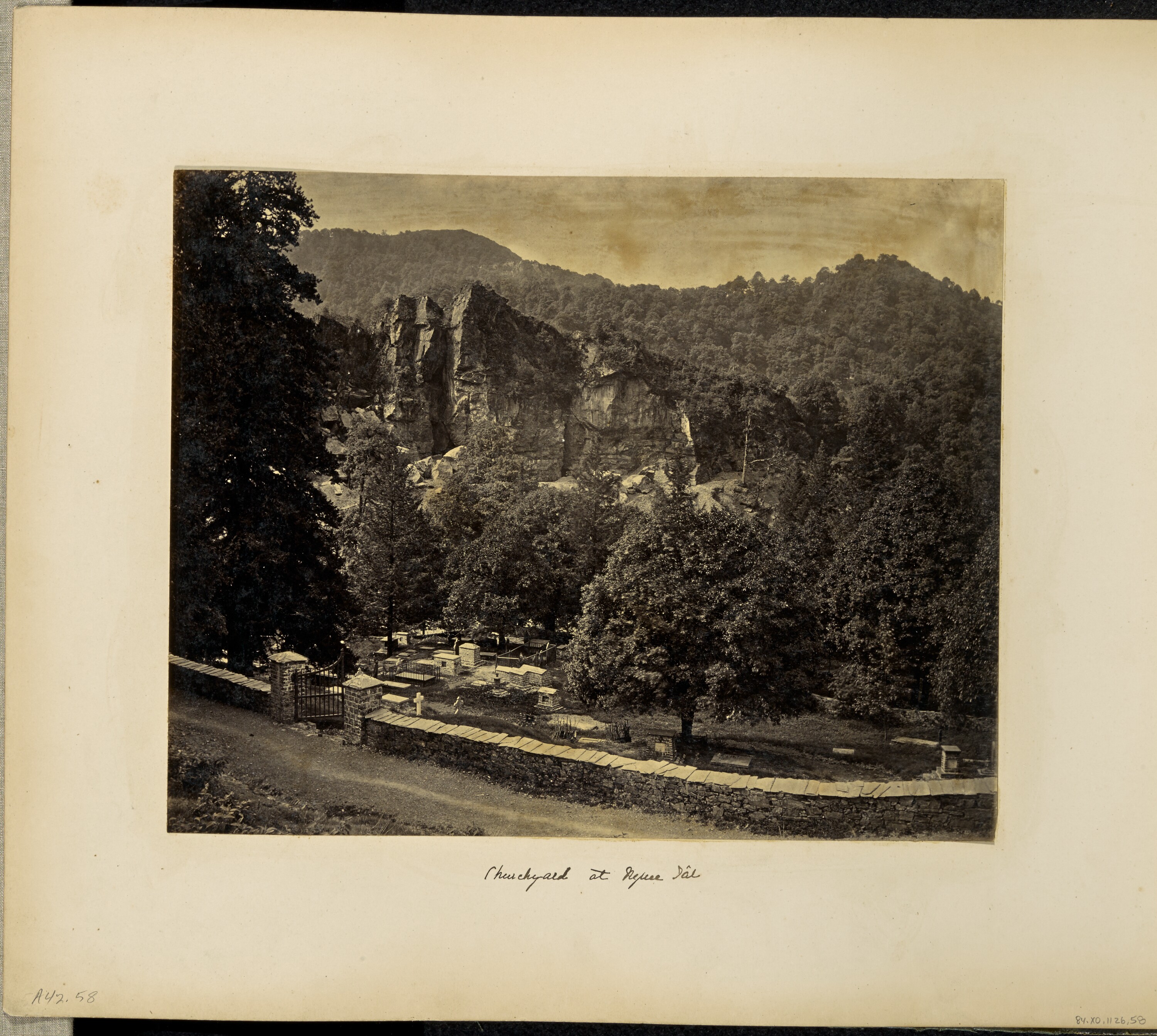
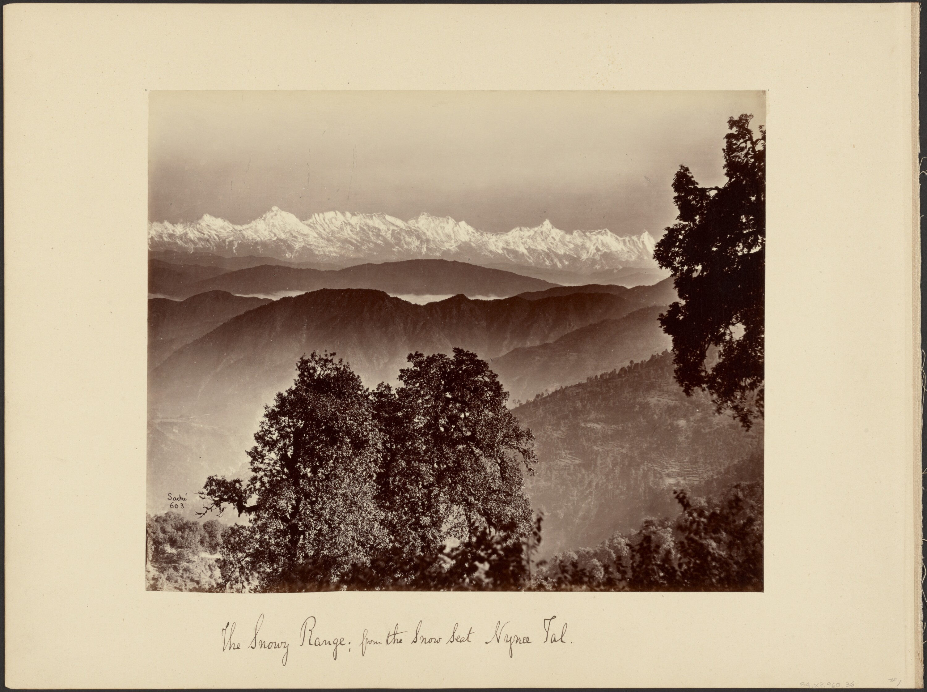
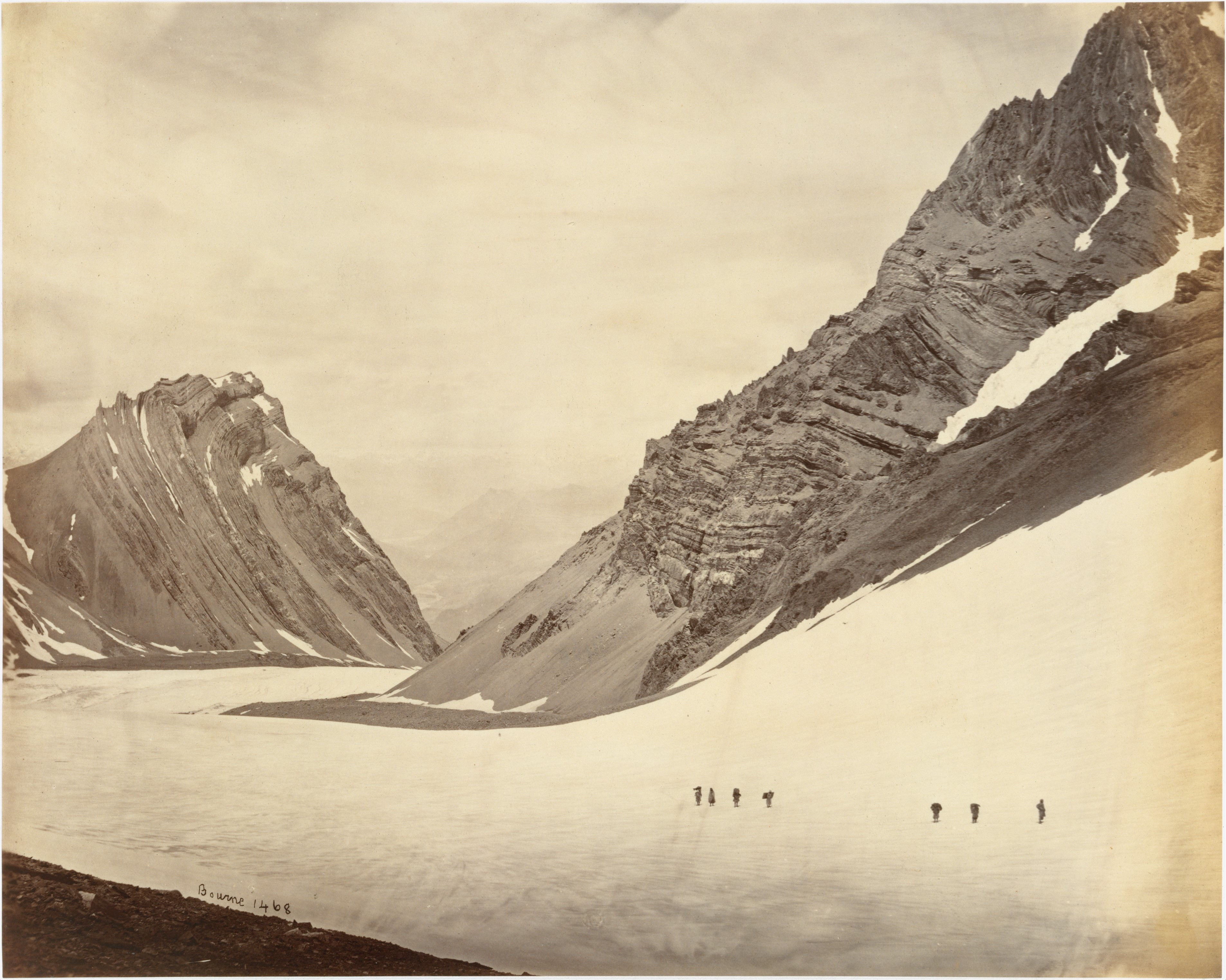
after these photographers, Samuel Bourne (1834–1912) also worked in Nainital during the 1860s, producing a number of views of the lake as part of his wider photographic practice in north india. bourne is often regarded as one of the leading photographers of the period, particularly for his work in the himalayas. his images of nainital, however, follow familiar compositions, showing the lake from elevated vantage points, with the surrounding slopes and built edges already taking a recognisable form. in this respect, they do not depart significantly from the views already established in earlier photographs by murray or in the more extensive series produced by sache. this is not to diminish his work elsewhere; his photographs from the higher himalayas, including those made at the Manirang Pass during his 1866 expedition, remain among the most striking of the period. there, working at elevations of over 18,000 feet and transporting glass plates and chemicals with large teams of porters, he produced some of the earliest high-altitude photographs on record. in nainital, however, his images sit within an already established way of seeing the place.
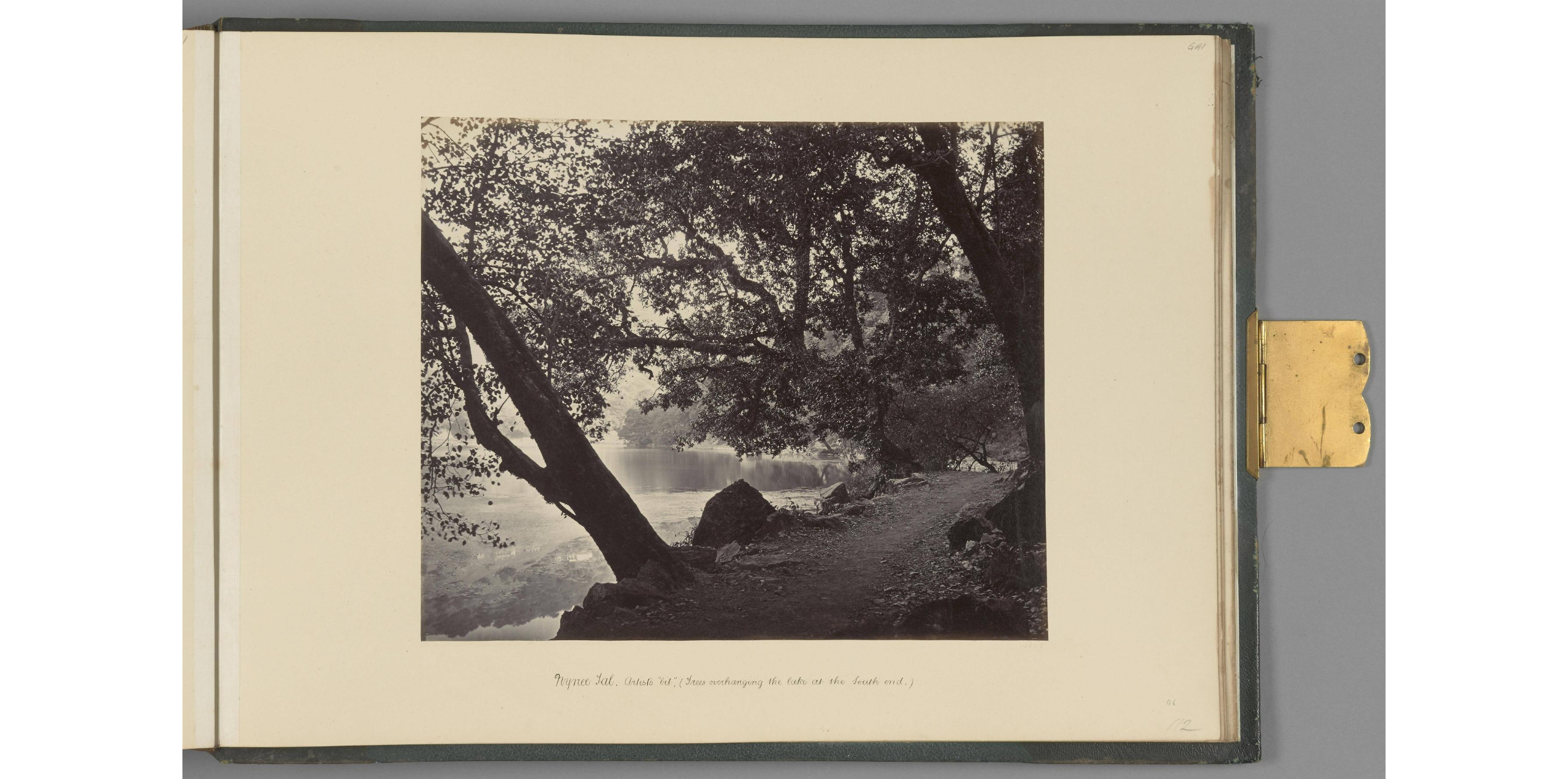
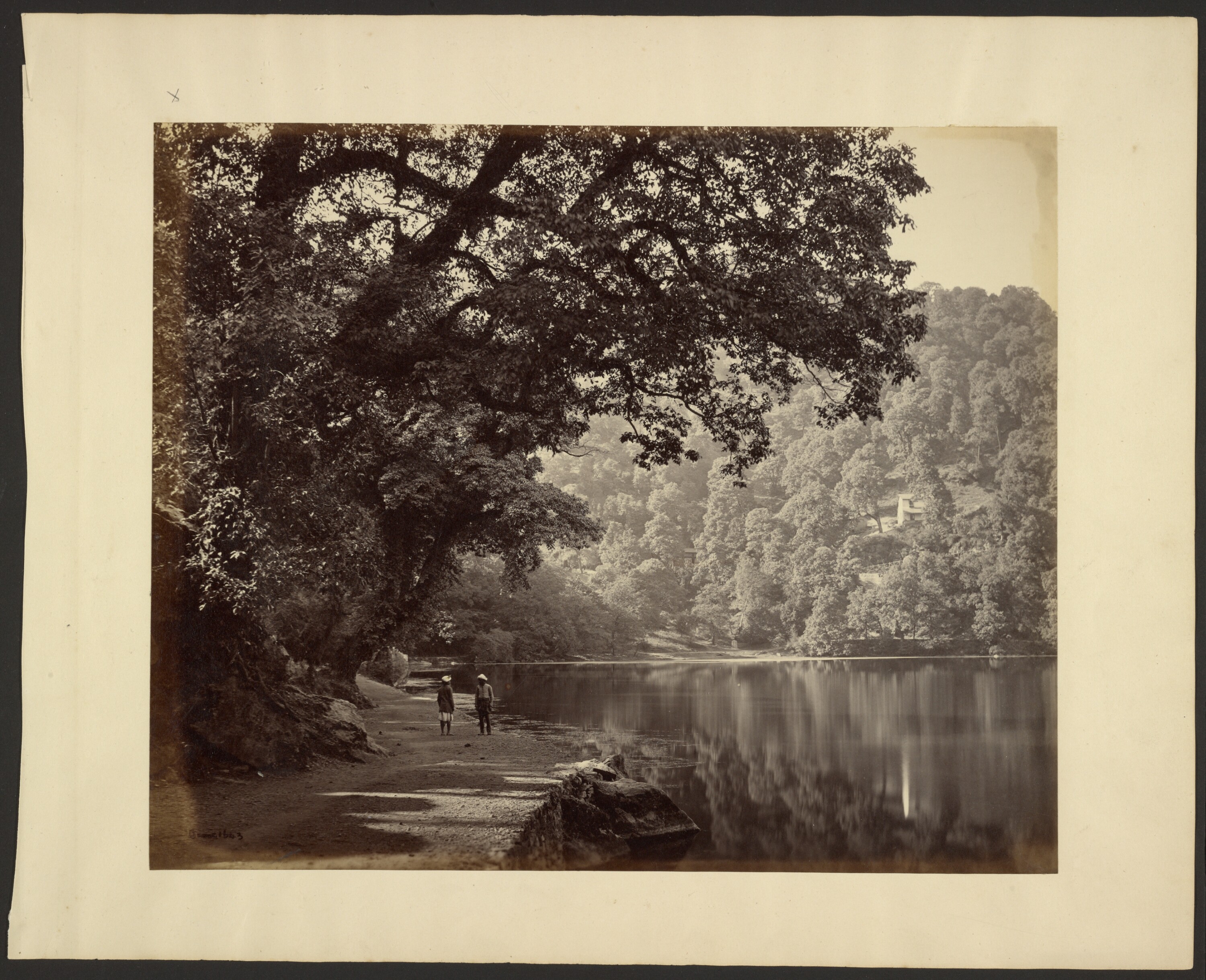
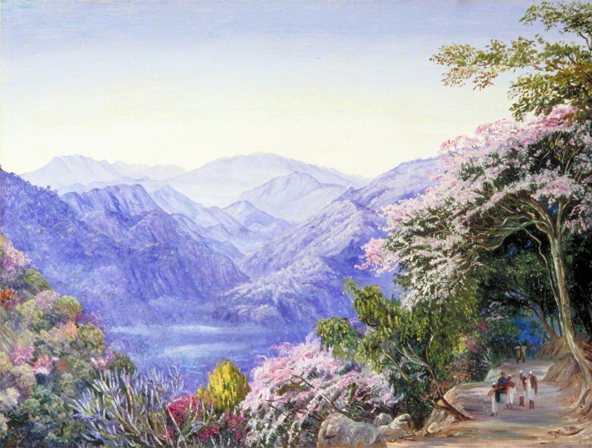
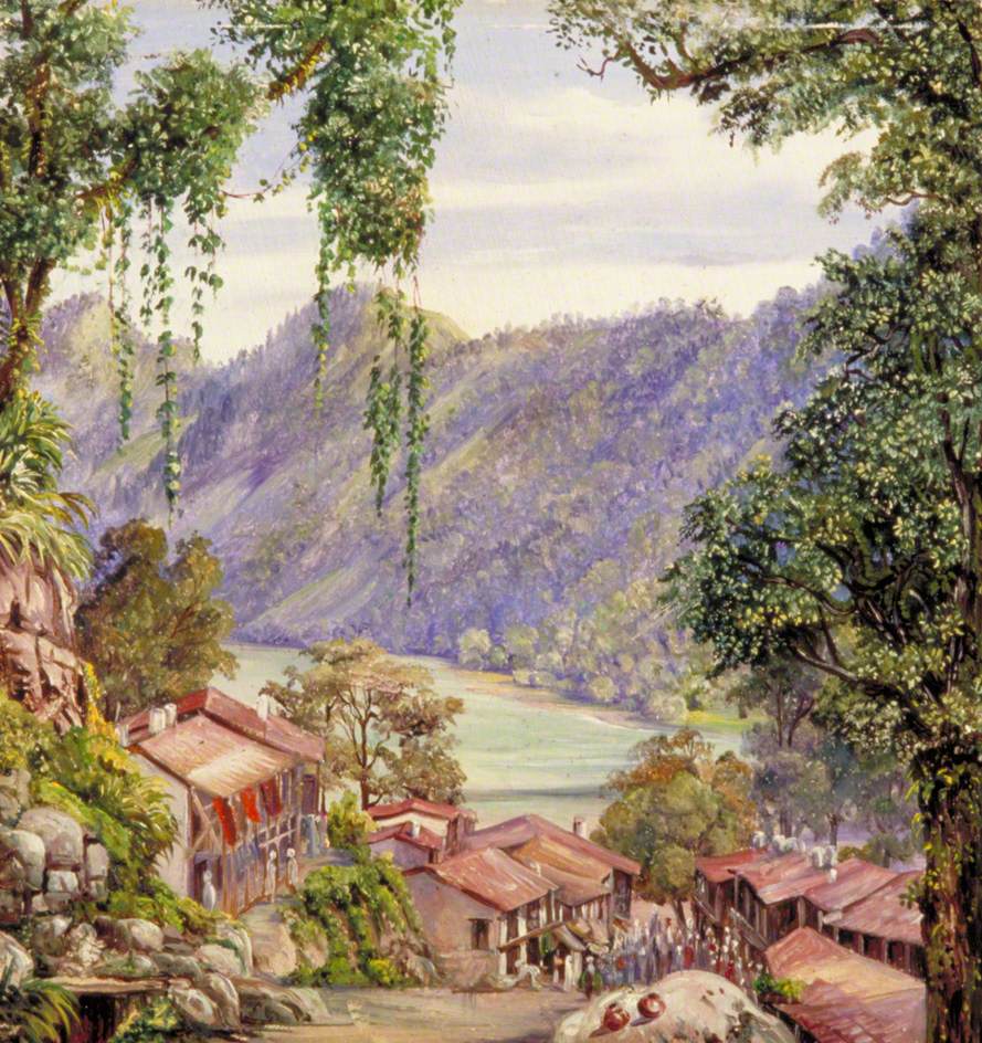
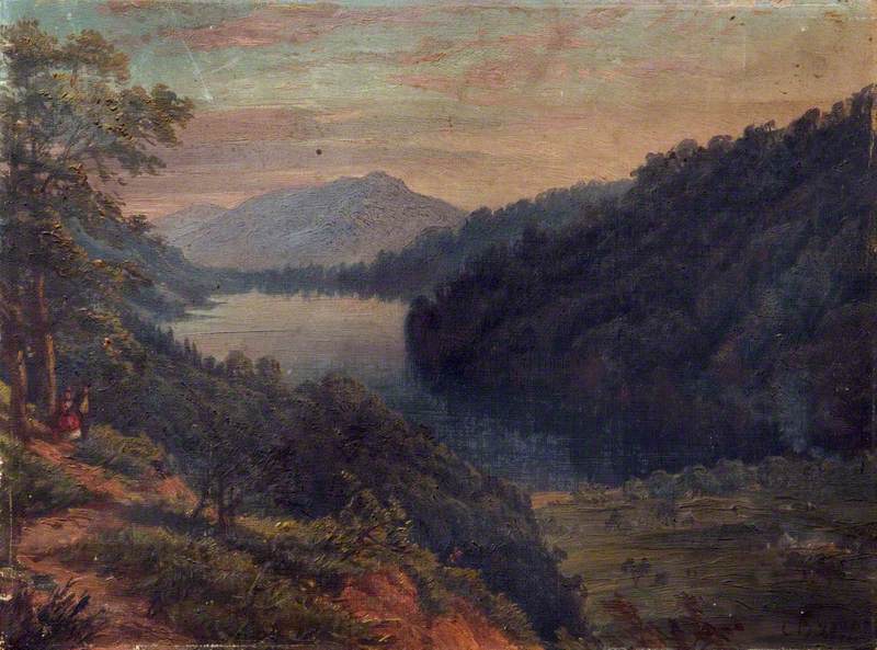
among those who painted in Nainital was Marianne North (1830–1890), a trained botanical artist known for her work in natural history illustration. she painted directly from life, often working outdoors, and was attentive to the form and detail of plants in their natural setting. her views of nainital place vegetation in the foreground, with the lake and the settlement appearing beyond it. this shifts the focus of the scene, giving priority to plant life rather than to the arrangement of the town. her paintings add another mode of observation to the record of the hill station, one grounded in the practices of natural history.
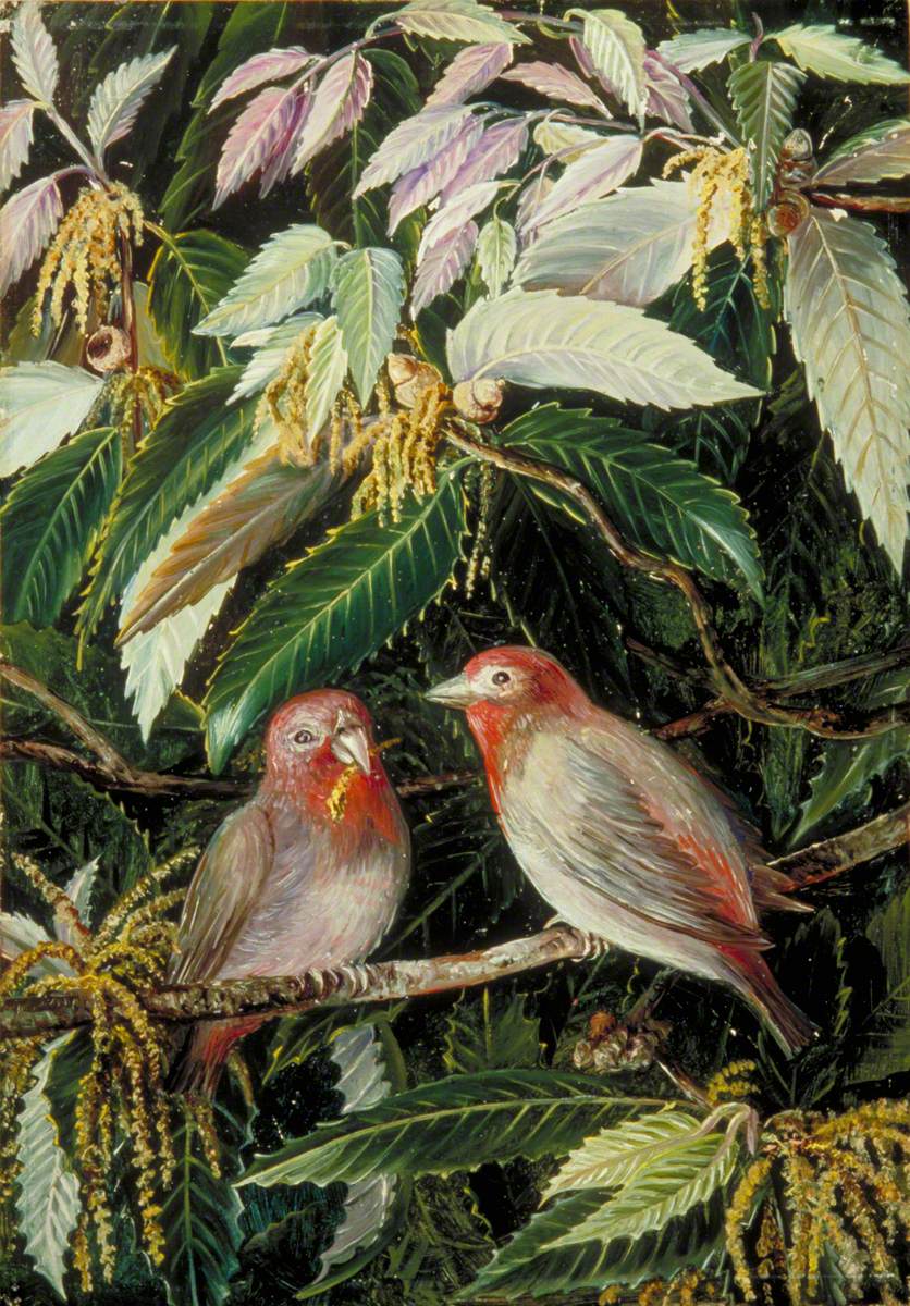
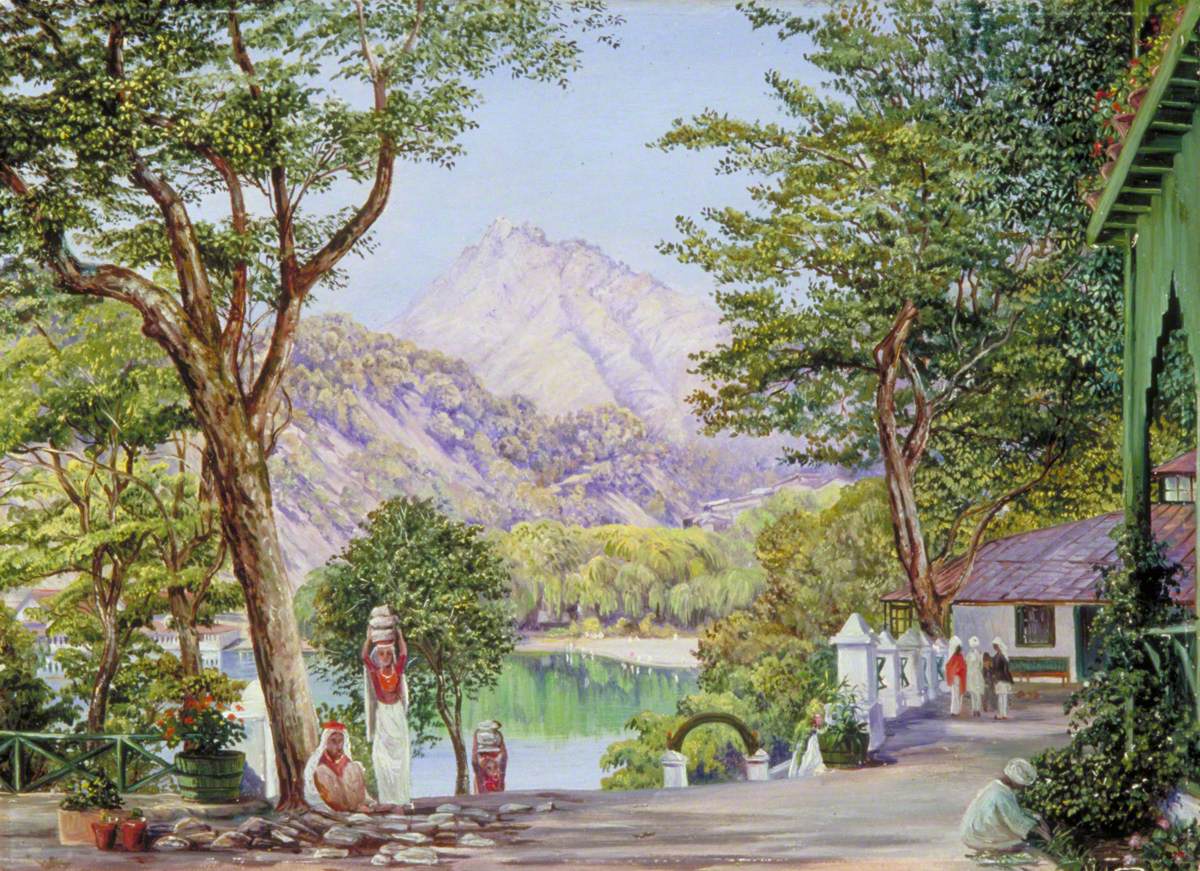
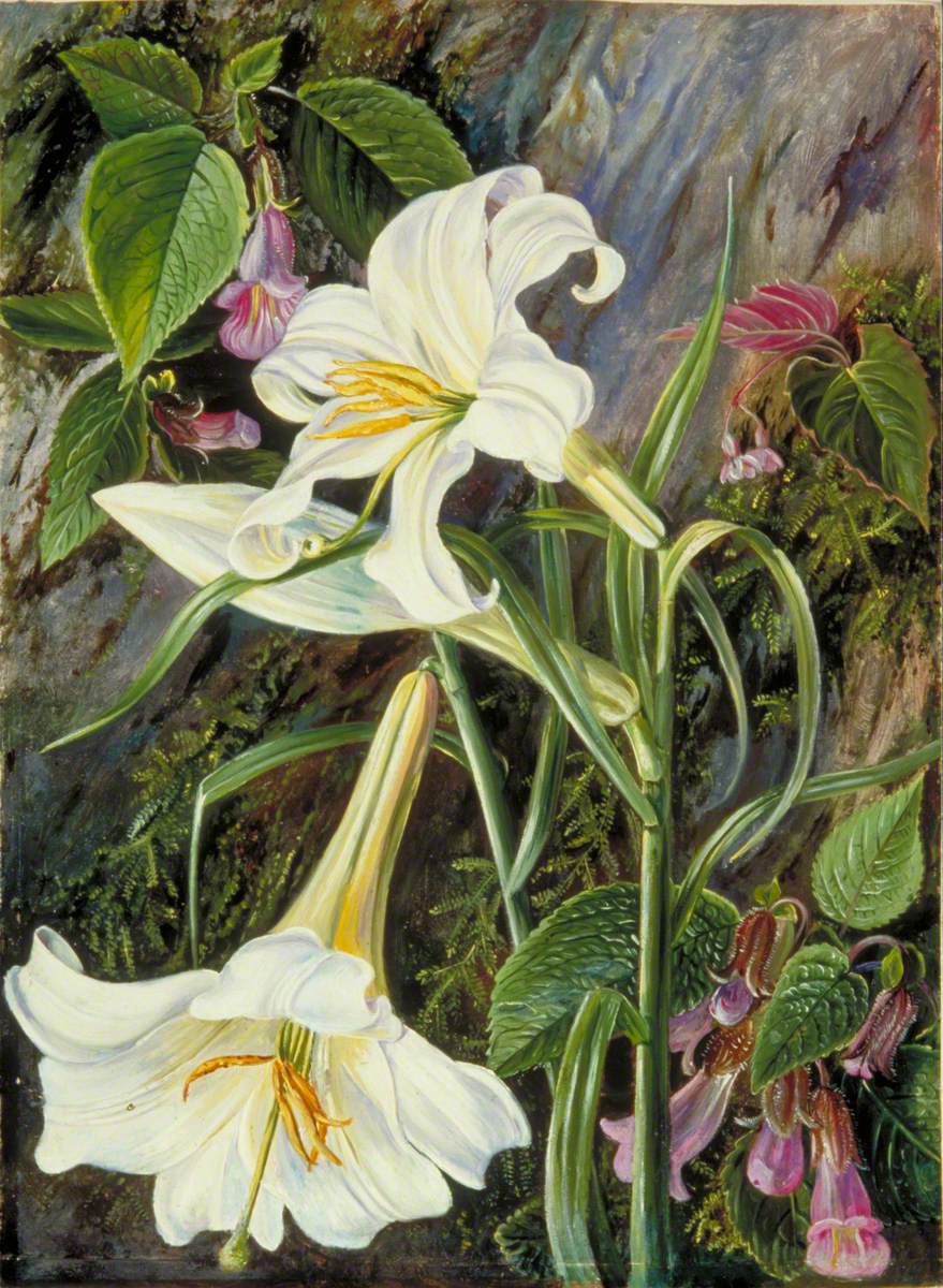
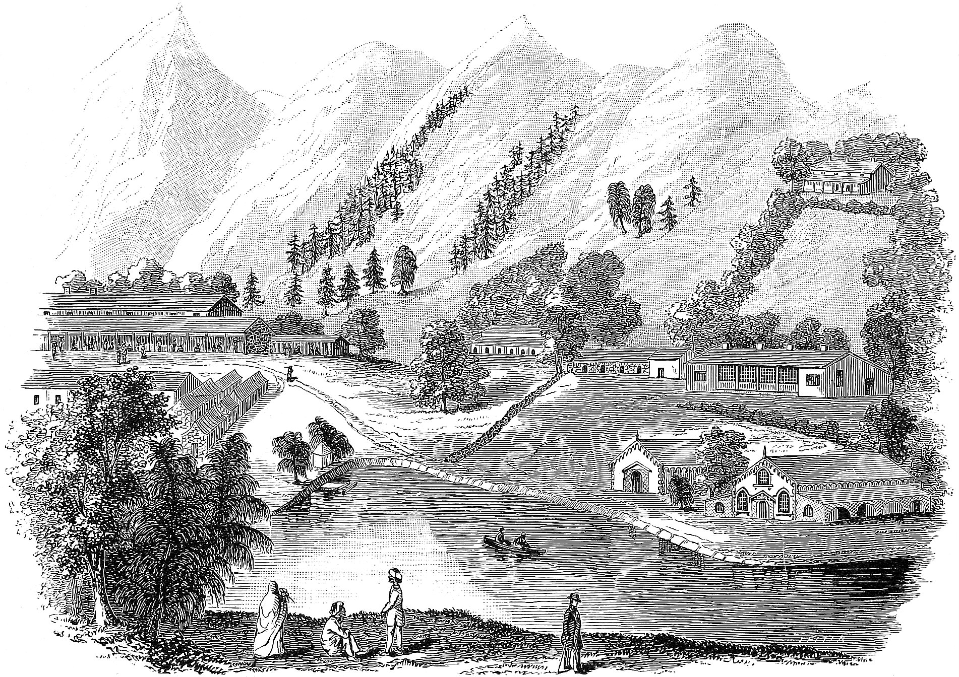
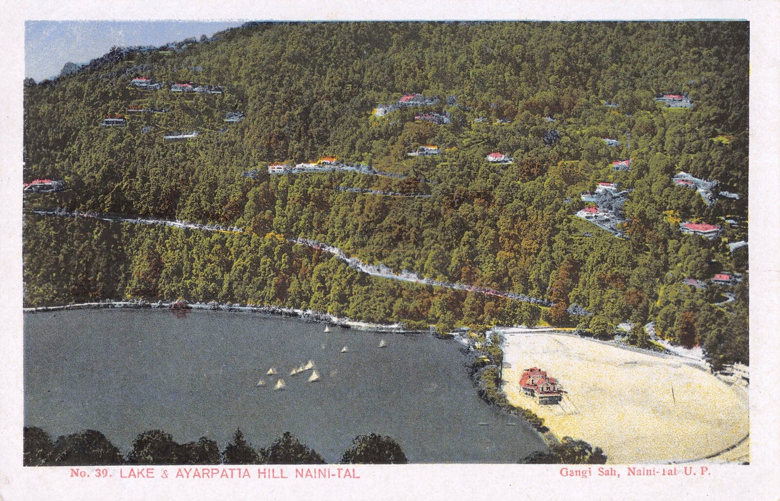
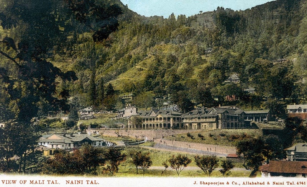
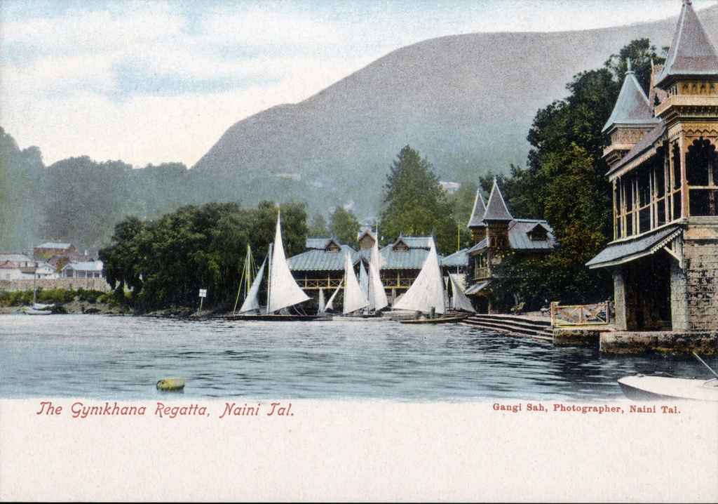
alongside these works, a range of sketches, paintings, and later postcards from the turn of the century onwards show how views of Nainital continued to circulate in different forms. what follows here are just a few examples. these images repeat familiar vantage points, but in formats that were easier to reproduce and share. they mark a shift in how the place was seen, moving from individual works to images that could travel more widely.
a mountain laboratory: medicine and science in nainital
“it was probably ennui that, at the beginning of the hot weather, brought on an attack of fever. mrs. dottie lost her pretty english colour, and the regimental ‘pill’ prescribed the hills. freddy took her up to nynee tal, and settled her at a tiny chalet on the rhododendron heights … naughty nynee was very full that season, and the fun was fast and furious round the lovers’ lake. the honourable reggy was the lieutenant-governor’s a.d.c., very fascinating, as many a grass-widow at many a hill station would aver, and the hero of a cause célèbre out of which he had escaped by the skin of his teeth.” (Cuthell, p. 76–77).
this passage appears in In Tent and Bungalow (1892) by Edith Cuthell, and is fairly typical of how Nainital was written into view. the hills enter as remedy and diversion, while the lake becomes a setting for a season of social life shaped by gossip and flirtation, with scandal never far behind. it travels easily from one telling to the next. much of what still circulates about the town keeps close to this tone. the images considered above move within a similar frame. they show the gradual accumulation of this social world around the lake, as buildings gather along the shoreline and the slopes begin to fill in. the place takes on a recognisable form, shaped as much by habit and season as by design.
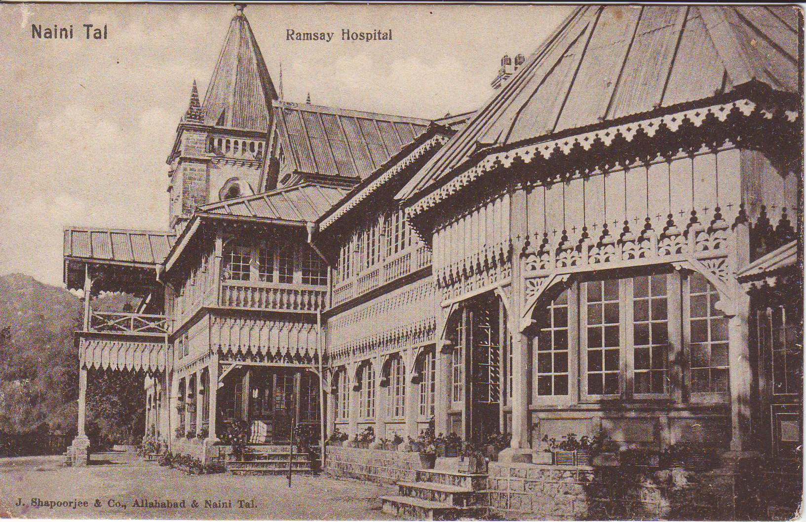
what receives more attention, at least in historical writing, is the medical role of hill stations. work by Dane Kennedy and other historians has shown how places like Nainital were framed as sites of recuperation, where climate was treated as a form of therapy and the movement to the hills became part of colonial medical practice (Kennedy 1996). this aspect of the town is still legible in its historical institutions: the sanitarium at Bhowali, and hospitals such as Ramsay Hospital and Croswaite (now B.D. Pandey) Hospital, which mark its role in regimes of treatment and care (Clay 1927, p. 18–19). historians will be familiar with this side of nainital, even if it is less present in popular memory.
 click to expand
what remains less visible is the extent to which the same landscape was approached in other ways. beyond its visual appeal, it offered conditions that made it useful for observation and measurement, a possibility that is easy to miss in accounts shaped by nostalgia. between its founding as a hill station in 1841 and the close of the century, the town and its surrounding kumaon district became an important base for scientific work in colonial india. set at around 2,000 metres on the southern slopes of the himalaya, and positioned between the plains and the higher ranges to the north, nainital provided an advantageous site for a wide range of enquiry. its elevation allowed for the study of weather systems and atmospheric variation, while the surrounding forests and hills supported work in natural history and geology. at the same time, its relative accessibility meant that expeditions into the higher himalaya could be organised and outfitted here, before moving further north. the nineteenth century saw a number of such instances, including several firsts; here, the work of the Schlagintweit brothers in 1855, and later that of Carl Diener in 1892, is used as an illustrative case.
in 1854, the three brothers Hermann Schlagintweit, Adolph Schlagintweit, and Robert Schlagintweit arrived in india on a scientific commission of unusual scope. the project had been proposed to the East India Company by the prussian naturalist Alexander von Humboldt, and was supported jointly by the prussian crown and the company. its aim was to extend a global network of geomagnetic observations associated with humboldt and the irish physicist Edward Sabine, whose work helped organise magnetic measurements across different parts of the world. across the subcontinent and into the himalaya, the brothers carried out coordinated measurements of terrestrial magnetism, atmospheric pressure, temperature, and altitude. this form of work, based on the comparison of observations taken across different regions, is often described as humboldtian science (Brescius 2021).
in march 1855, adolph and robert schlagintweit reached Nainital, which served as their first significant base in the himalaya. from here they moved northward toward the nanda devi region and the milam glacier. during their stay at nainital and at almora, they conducted earth-magnetic observations and experiments on carbonic acid in relation to altitude. these measurements formed part of a wider effort to trace variation in the earth’s magnetic field across latitude and elevation. the results obtained at nainital were therefore incorporated into a much larger programme of coordinated scientific work.
the schlagintweits also made use of photography during their journey, treating it as part of their field practice rather than as a separate activity. images taken along their route, including those north of nainital, are among the earliest photographic records of the central himalaya. alongside these, however, are their drawings and paintings, which record glacial landscapes such as the Pindari Glacier with a level of detail that remains striking today. these visual records, produced in the course of measurement rather than apart from it, extend the scope of their work beyond instrumentation, and remain part of the longer record through which such environments are now understood.
the following letter (Schlagintweit 1855), written by Adolph Schlagintweit from Nainital in may 1855 to Alexander von Humboldt, gives a direct account of their work in the region.
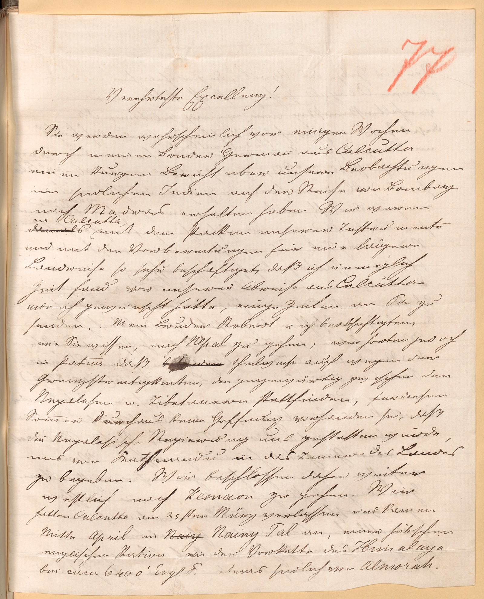
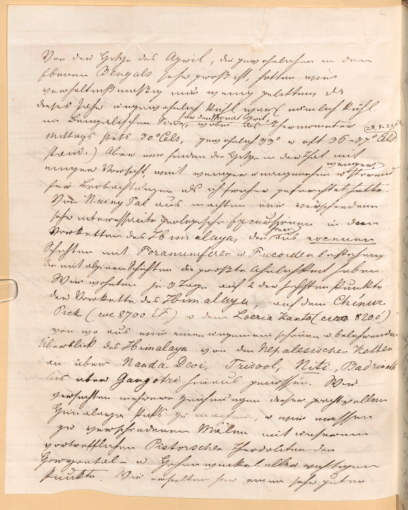
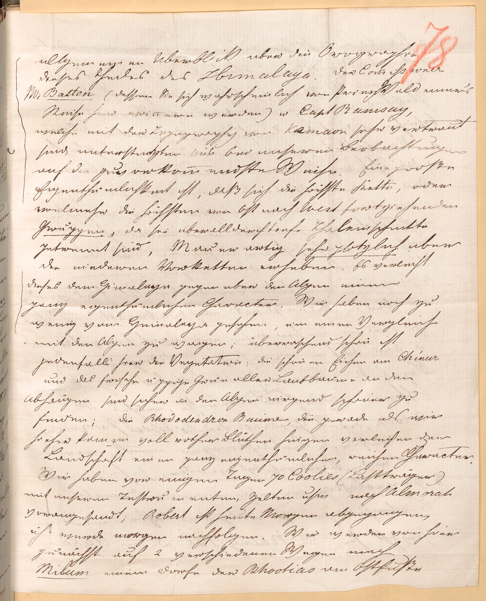
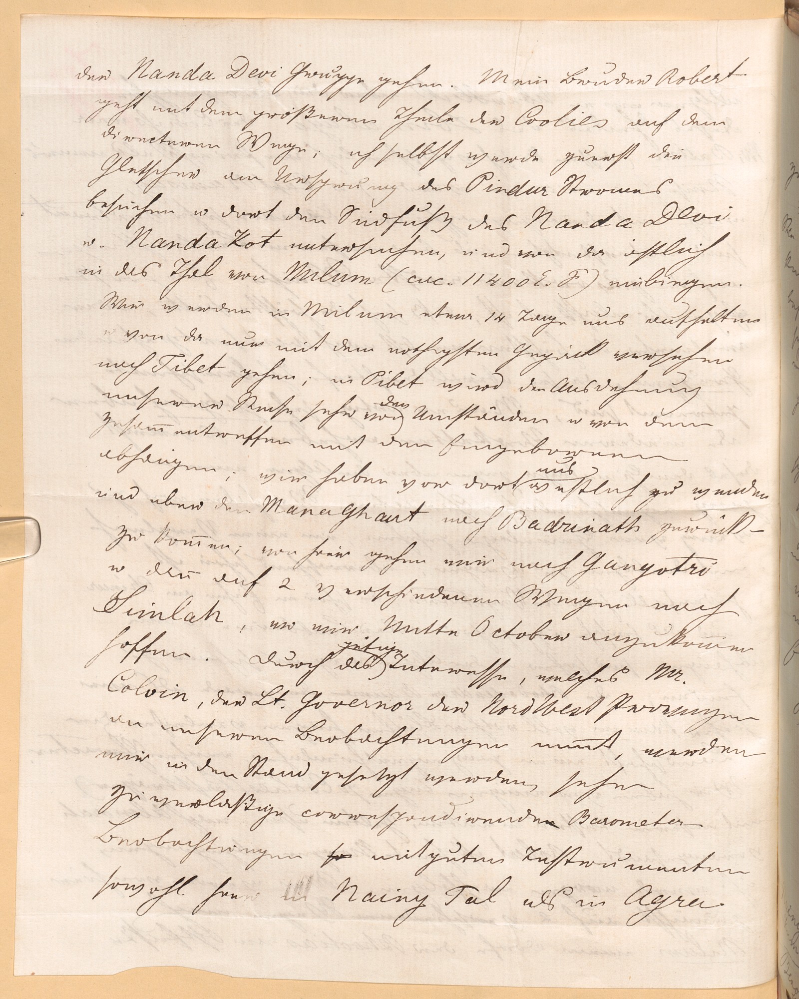
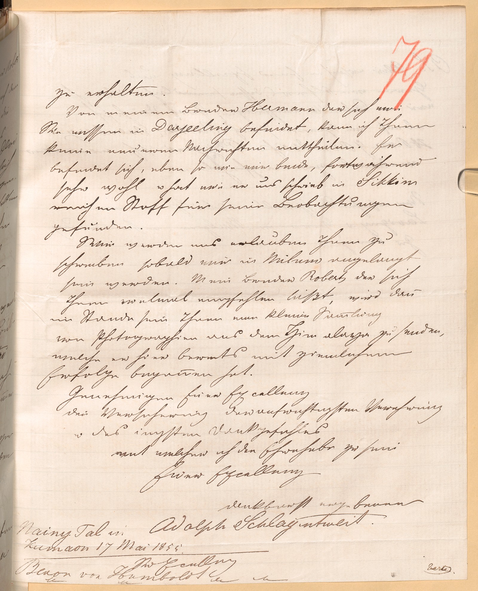
English translation:
most honored excellency,
a few weeks ago you probably received, through my brother hermann in calcutta, a brief report on our observations in southern india during the journey from bombay to madras. at that time, we were so occupied in calcutta with packing our instruments and making preparations for a longer overland journey that i was quite unable, before our departure—as i would have wished—to send you a few lines.
my brother robert and i had intended, as you know, to go to nepal; however, in patna we heard that, partly because of the border disputes currently taking place between the nepalese and the tibetans, there was absolutely no hope for this summer that the nepalese government would permit us to proceed from kathmandu into the interior of the country. we therefore decided to travel further west to kumaon. we left calcutta on the 25th of march and arrived in mid-april at naini tal, a charming english station in the foothills of the himalaya at approximately 6,400 english feet, somewhat south of almora.
from the heat of april—which is usually very great in the plains of bengal—we suffered comparatively little, since this year was unusually cool (that is, cool in the bengali sense for the month of april, with the thermometer at midday always at 30°c, usually 33°, and often 36–37°c). but we found that the heat, with some caution, was in fact far less unpleasant and less disruptive to observations than i had previously feared.
from naini tal we undertook several very interesting geological excursions into the foothills of the himalaya, which here consist of eocene strata containing foraminifera and fucoids, and which bear the greatest resemblance to alpine formations. we stayed for three days each on two of the highest points of the himalayan foothills, chinur peak (about 8,700 english feet) and loeria kanta (about 8,200 feet), from which we enjoyed an extraordinarily beautiful and instructive panoramic view of the himalaya—from the nepalese ranges across nanda devi, trisul, niti, and badrinath to beyond gangotri. we attempted to make several drawings of these magnificent himalayan peaks, and on various occasions we measured, with our excellent pistor theodolite, the horizontal and vertical angles of all the important points. in this way, we obtained a very good general overview of the orography of this part of the himalaya.
the commissioner, mr. batten (whom you will probably remember from prince waldemar's journey), and captain ramsay, who are very familiar with the topography of kumaon, assisted us in the most obliging manner with several observations. a notable peculiarity is that the highest chain—or rather the highest groups running from east to west, since they are everywhere separated by deep valley cuts—rise very abruptly, like a wall, above the lower northern ranges. this gives the himalaya, in comparison with the alps, a very distinctive character.
we have still seen too little of the himalaya to venture a full comparison with the alps; in any case, the vegetation here is strikingly beautiful. the fine oaks on chinur and the fresh, luxuriant greenery of all deciduous trees on the slopes are certainly nowhere more beautiful in the alps. the rhododendron trees, which were covered in red blossoms just as we arrived, lend the landscape a particularly rich and distinctive character.
a few days ago, we sent ahead seventy porters with our instruments, tents, and other equipment to almora. robert set out this morning; i shall follow tomorrow. from here, we will proceed by two different routes to milam, a village of the bhotias at the eastern foot of the nanda devi group. my brother robert will take the more direct route with the larger portion of the porters; i myself will first visit the glaciers at the source of the pindar river and there examine the southern foot of nanda devi and nanda kot, and from there turn eastward into the valley of milam (about 11,400 english feet).
we intend to remain in milam for about fourteen days and from there proceed into tibet with only the most necessary luggage. in tibet, the extent of our journey will depend greatly on circumstances and on encounters with the local inhabitants; we plan to turn westward there and return via the mana pass to badrinath. from there we will go to gangotri and then by two different routes to simla, where we hope to arrive by mid-october.
thanks to the kind interest that mr. colvin, the lieutenant-governor of the north-western provinces, takes in our observations, we shall be enabled to carry out very reliable corresponding barometric observations with good instruments, both here in naini tal and in agra.
i have no more recent news to share with you about my brother hermann, who, as you know, is in darjeeling. he, like the two of us, continues to be in very good health and, as he wrote to us, has found abundant material for his observations in sikkim.
we shall take the liberty of writing to you as soon as we have arrived in milam. my brother robert, who sends you his respectful regards once again, will then be in a position to send you a small collection of photographs from the himalaya, which he has already begun here with considerable success.
kindly accept, your excellency, the assurance of the most sincere respect and deepest gratitude, with which i have the honor to remain,
your excellency's most gratefully devoted
adolph schlagintweit
naini tal in kumaon, 17 may 1855
to his excellency baron von humboldt
by the early 1890s, this pattern of scientific work had become more organised, though its aims had also become more specialised. the expedition led by Carl Diener in 1892 was conceived as a targeted effort to assemble a more complete fossil record of the central himalaya, building on earlier collections and the recommendations of specialists in vienna (Diener 1895). the project brought together the Geological Survey of India and european scientific institutions, reflecting a growing coordination between field collection and metropolitan analysis.
the execution of this work, however, depended on conditions that were far less stable. after travelling by rail to kathgodam, diener and his colleagues moved to Nainital, where they spent several days preparing for the journey into the high mountains. here, equipment was assembled, provisions were secured, and porters were recruited, though this last proved difficult due to a cholera outbreak in the region that disrupted local labor supply and delayed the expedition’s departure. even at this stage, scientific work remained dependent on the willingness of local communities to participate, and on circumstances that could not be fully controlled (derived from Hubmann and Seidl 2012).
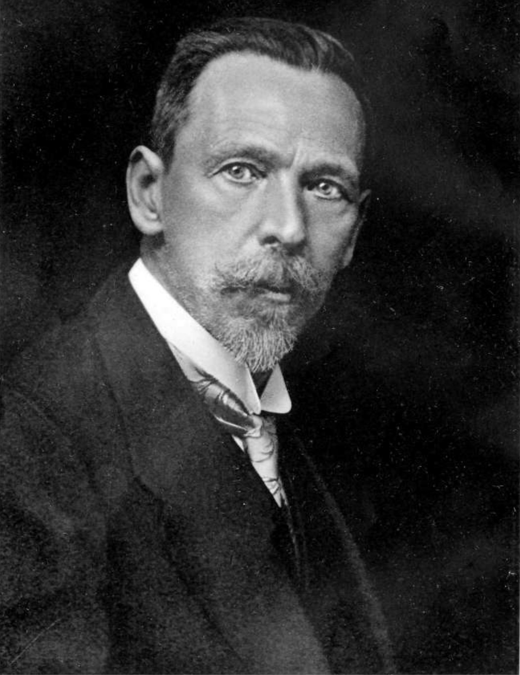
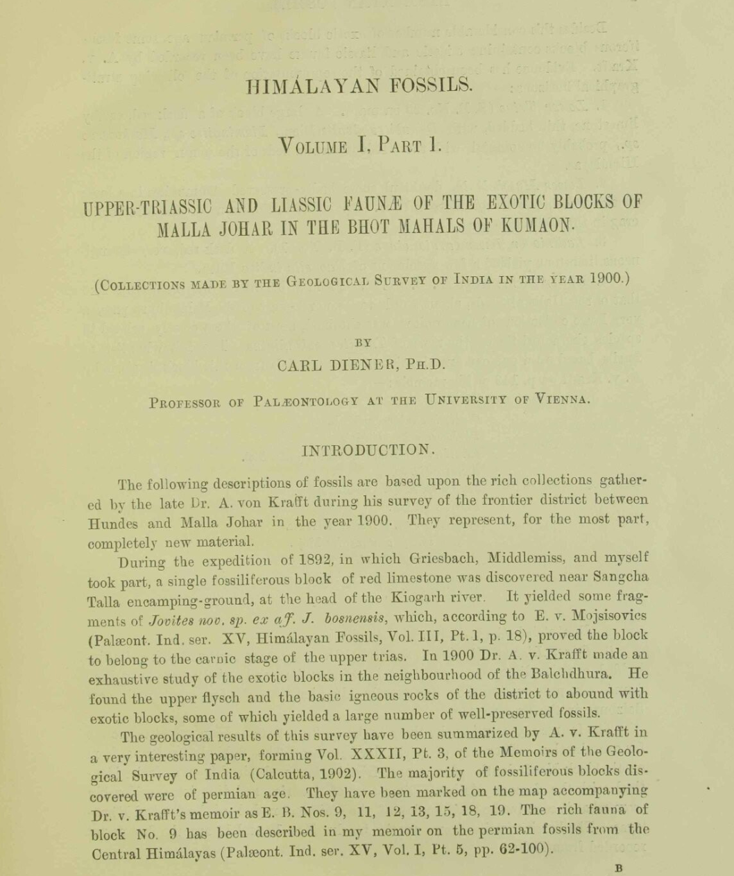
once these arrangements were in place, the expedition moved forward in stages, carrying with it the material requirements of high-altitude fieldwork: tents, instruments, weapons, photographic equipment, and provisions that could not be obtained beyond the hill stations . from nainital, loads were dispatched ahead to almora, and the full party—comprising geologists, assistants, and a large number of porters—set out toward the higher ranges. this process makes clear the role of nainital as more than a point of observation. it functioned as a logistical base, where railway access, administrative authority, and local labour networks converged, enabling scientific work to extend into regions that could not be reached or sustained without such support (Hubmann and Seidl 2012).
the scientific life of Nainital sits uneasily alongside its more familiar image as a site of leisure, shaped by anecdotes of society and scandal that continue to circulate with ease. its role in the organisation of scientific work has drawn far less attention, though it was no less central to the production of knowledge about the himalaya. this article is offered in the hope that others will pursue these scientific and visual histories further.
references
- archer, mildred, and toby falk. 1989. india revealed: the art and adventures of james and william fraser 1801–35. cassell.
- barron, pilgrim. 1844. notes of wanderings in the himmala. t. w. brown.
- batten, john h. 1851. official reports on the province of kumaon: with a medical report on the mahamurree in gurhwal, in 1849–50. secundra orphan press.
- brescius, moritz von. 2021. “empires of opportunity: german naturalists in british india and the frictions of transnational science.” modern asian studies 55, no. 6 (2021): 1926–71. https://doi.org/10.1017/S0026749X19000428.
- diener, carl. 1895. “ergebnisse einer geologischen expedition in den zentral-himalaya von johar, hundes und painkandha.” denkschriften der kaiserlichen akademie der wissenschaften, mathematisch-naturwissenschaftliche klasse 62 (1895).
- clay, j. m. 1927. nainital: a historical and descriptive account. government press.
- cuthell, edith. 1892. in tent and bungalow. methuen & co.
- fraser, james baillie. 1820. “an account of a journey to the sources of the jumna and bhagirathi rivers.” asiatic researches 13 (1820): 171–250.
- headrick, daniel r. 1988. the tentacles of progress: technology transfer in the age of imperialism, 1850–1940. oxford university press.
- hubmann, bernhard, and johannes seidl. 2012. “carl diener’s expedition to the himalayas - an international research project in 1892.” mitteilungen der österreichischen geographischen gesellschaft 154 (2012): 322–34.
- joshi, bhoomika. 2025. “landscape aesthetics of remoteness in the indian himalayas.” himalaya 44, no. 1 (2025). https://doi.org/10.2218/himalaya.2025.9589.
- kennedy, dane. 1996. the magic mountains: hill stations and the british raj. university of california press.
- maitreyee, rupin. 2018. “prospecting wasteland: the ‘discovery’ of nainital.” journal of studies in history & culture 3, no. 3 (2018).
- nevill, h. r. 1904. nainital: a gazetteer. government press.
- pande, badri datt. 1993. history of kumaon. translated by c. m. agrawal. 2 vols. shyam prakashan.
- schlagintweit, adolph. 1855. “adolph schlagintweit an alexander von humboldt. nainital, 17. mai 1855.” to alexander von humboldt. edition humboldt digital. may 17, 1855. h0019124. berlin-brandenburgische akademie der wissenschaften. https://edition-humboldt.de/v10/H0019124.
- tolia, r. s. 2009. founders of modern administration in uttarakhand, 1815–1884: edward gardner to henry ramsay. bishen singh mahendra pal singh.
- traill, george w. 1828. “statistical sketch of kumaon.” asiatick researches (calcutta) xvi (1828): 137–234.
- webb, william. 1834. altitude of places and stations in kumaon from barometrical observations. w. clowes.